VIDEOS
 |
 |
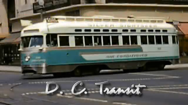 |
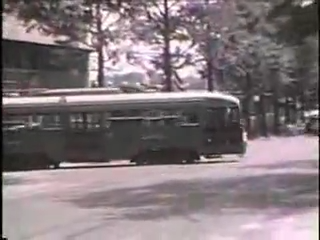
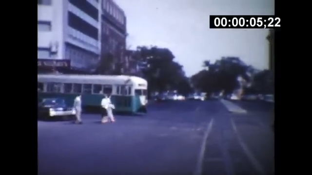
| Above: YouTubeCA video - DC Streetcars on 14th Street (Early 1950's) - Length: 3:53 mins. | Above: YouTubeCA video - Streetcars in 1950s Washington, D.C. - Length: 18:52 mins. | Above: YouTubeCA video - DC Transit - Length: 10:58 mins. |
PHOTOS
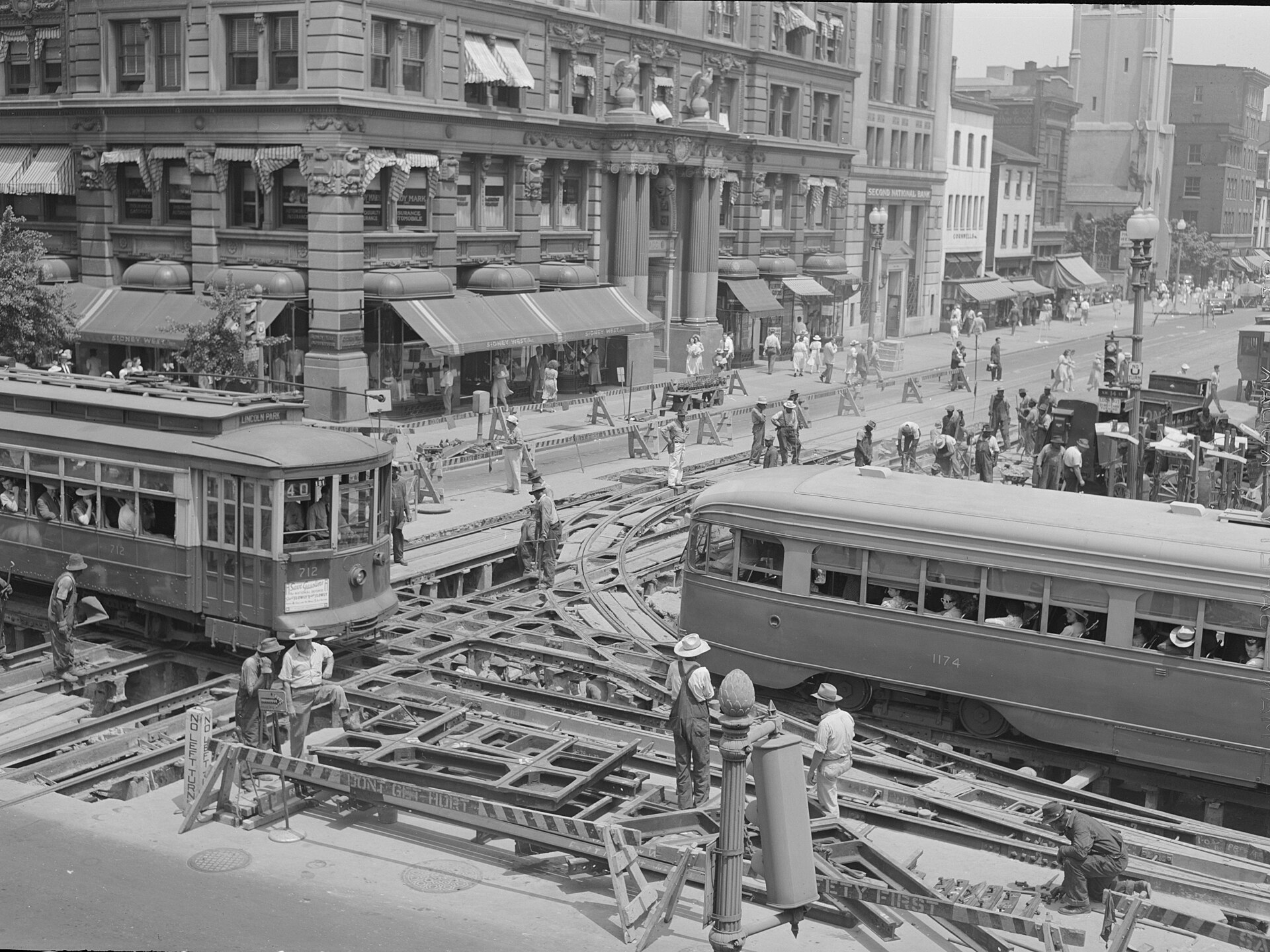 |
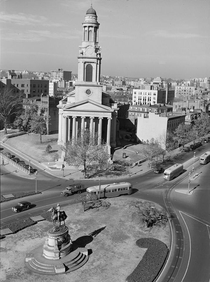 |
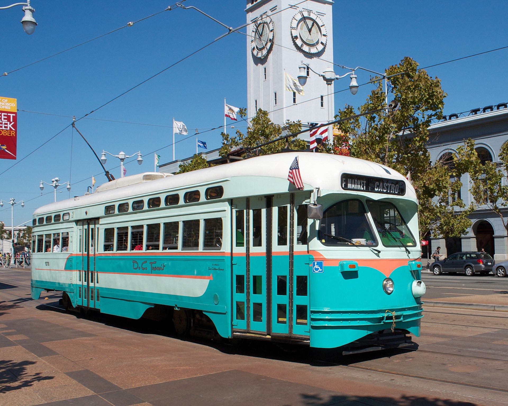 |
MAPS
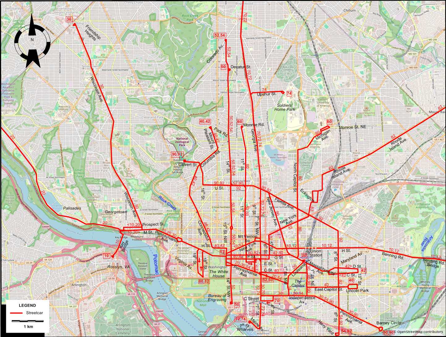
INSET: THE LARGER WASHINGTON AREA
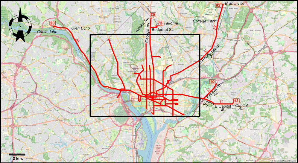
I created the above maps by overlaying OpenStreetMap (OSM) maps with my own data. The underlying map data is © OpenStreetMap contributors, licensed under the Open Database License (ODbL).
Please note that the OSM maps used as a template for these maps corresponds to the situation at the time the map was downloaded and may show features that did not exist at the time the GS Tram Site is supposed to show. In particular, it may show bridges and highways that were built later.
DISCONTINUATION DATES OF STREETCAR TRACKS BETWEEN 1946 AND 1958 (affected route numbers in parentheses).
- 1948 Dec. 24: Rosslyn, VA - Key Bridge (10)
- 1949 May 1: New York Av. - Mt. Vernon Sq. - H St. - Benning Rd. - Benning Rd. Bridge [today Ethel Kennedy Bridge] - Kenilworth / Capitol Heights (10, 12)
- 1949 Aug. 28: Louisiana Av. (20)
STREETCAR ROUTES
Operator: Capital Transit Company (ancestor of DC Transit, one of the constituent companies of the Washington Metropolitan Area Transit Authority (WMATA))
| 10 | Rosslyn, VA - Key Bridge - M St. [back: Wisconsin Av. - Prospect St.- 34th St.] - M Street - Pennsylvania Av. - The White House - New York Av. - Mt. Vernon Sq. - H St. - Benning Rd. - Benning Rd. Bridge [today Ethel Kennedy Bridge] - Kenilworth Av. - Kenilworth (Quarles St.) |
| 12 | New York Av. & 15th St. - New York Av. - Mt. Vernon Sq. - H St. - Benning Rd. - Benning Rd. Bridge [today Ethel Kennedy Bridge] - Benning Rd. - E Capitol St. - Capitol Heights (Seat Pleasant) |
| 20 | Cabin John - Glen Echo - Palisades - M St. [back: Wisconsin Av. - Prospect St.- 34th St.] - M St. - Pennsylvania Av. - The White House - [15th Av. - E St.] [back: Pennsylvania Av.] - Pennsylvania Av. - 1st St. NW - Louisiana Av. - Union Station |
| 30 | Friendship Heights - Wisconsin Av. - M St. - Pennsylvania Av. - The White House - [15th Av. - E St.] [back: Pennsylvania Av.] - Pennsylvania Av. - 7st St. - Independence Av. - Pennsylvania Av. - Barney Circle |
| 40 | Park Rd. - Mount Pleasant St. - Columbia Rd. - Connecticut Av. - H St. NW - 15th St. NW - F St. NW - 9th St. NW - Pennsylvania Avenue NW - C St. NW - 1st St. NE - East Capitol St. - Lincoln Park |
| 42 | Park Rd. - Mount Pleasant St. - Columbia Rd. - Connecticut Av. - H St. NW - 15th St. NW - F St. NW - 5th St. NW - G St. - Union Station - Massachusetts Av. - [Maryland Av. - D St.] [back: C st. - 6th St.] - 13th St. |
| 50 | Decatur St. - 14th St. - Bureau of Engraving |
| 52 | 14th St. & Colorado Av. - 14th St. - U St. - 11th St. - [11th St. - E St. ] [back: 9th St. - F St.] - 9th St. - Pennsylvania Av. - 6th St. |
| 54 | 14th St. & Colorado Av. - 14th St. - Pennsylvania Av. - 1st St. NW - Independence Av. - Pennsylvania Av. - 8th St. - Navy Yard |
| 60 | 11th St. & Monroe Rd. - 14th St. - U St. - 11th St. - [11th St. - E St. ] [back: 9th St. - F St.] - 9th St. - Pennsylvania Av. - 6th St. |
| 70 | Georgia & Alaska - Georgia Av. - 7th St. - Independence Av. [back: C St. - 7th St.] - 4th St. |
| 72 | Takoma - 4th St. NW - Butternut St.- Georgia Av. - 7th St. - Maine Av. - 7th St. Wharves |
| 74 | Soldiers' Home Park - Upshur St. - Georgia Av. - 7th St. - Maine Av. - 7th St. Wharves |
| 80 | Virginia Av. - 18th St. [back: 19th St.] - The White House - G St. - Massachusetts Av. - North Capitol St. - Michigan Av. - Monroe St. NE |
| 82 | Virginia Av. - 18th St. [back: 19th St.] - The White House - G St. - 5th St. - New York Av. - Eckington - Rhode Island Av. - ROW - College Park - Branchville, MD |
| 90 | National Zoological Park - Calvert St. - 16th St. - U St. - Florida Av. - New Jersey Av. - Massachusetts Av. - Union Station - 1st St. - Pennsylvania Av. - Barney Circle |
| 92 | National Zoological Park - Calvert St. - 16th St. - U St. - Florida Av. - 8th St. - Navy Yard |
Note: Most of the Washington streetcar system ran on conduit power. Only in some suburban routes were overhead wires used.
CHARACTERISTICS OF THE SYSTEM
NETWORK LENGTH
- Streetcar lines: ca. 135 km.
HISTORY
- Streetcars (traditional): (horse-powered) 29 July 1862 - Apr. 1900; (electric) 17 Oct. 1888 - 28 Jan. 1962.
- Cable cars: 12 Apr. 1890 - 1897 (?)
- Streetcars (second generation): 27 Feb. 2016 - today.
- Metro: 27 March 1976 - today.
GAUGE
- Streetcars: 1435 mm.
- Metro: 1429 mm.
SOURCES
- Broehm, J. "Washington DC - Streetcars are coming back", Tramways & Urban Transit, May 2010 (73: 869), p.172-173.
- Grahl, A. "A wrap-up of Washington", Tramways & Urban Transit, Sept. 2025 (88: 1053), p.340-342.
- Simons, V. "DC streetcar developments", Tramways & Urban Transit, Jan. 2017 (80: 949), p.12-17.
- Washington (news item), The Modern Tramway, May 1959 (22:57), p.110.
WIKIS
- Capital Traction Company
- DC Streetcar
- Pennsylvania Avenue Line (Washington)
- Streetcars in Washington, D.C.
- Washington Metro
- Washington Metropolitan Area Transit Authority (WMATA)
WEB SITES
Copyright Gabor Sandi 1998-2026
Disclaimer: Everything on this site was written and/or prepared at the author's discretion. The author has tried to be accurate where facts are presented, but this does not mean that these facts are necessarily accurate. People needing more reliable information should refer to appropriate sources presented, on the Internet or elsewhere, by authoritative professional or academic bodies.
To get in touch with the webmaster, send an e-mail to g_sandi at hotmail.com.
Flags on this site are from the FOTW Flags Of The World website.