 |
 |
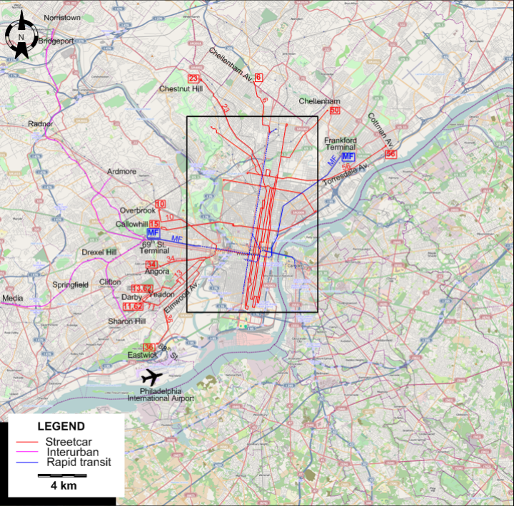
INSET: CENTRAL PHILADELPHIA
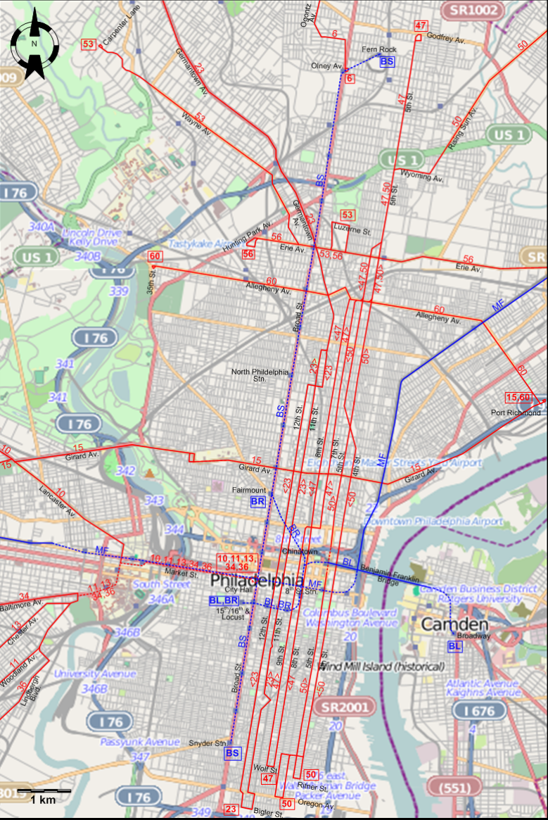
I created the above maps by overlaying OpenStreetMap (OSM) maps with my own data. The underlying map data is © OpenStreetMap contributors, licensed under the Open Database License (ODbL).
Please note that the OSM maps used as a template for these maps corresponds to the situation at the time the map was downloaded and may show features that did not exist at the time the GS Tram Site is supposed to show. In particular, it may show bridges and highways that were built later.
ROUTES
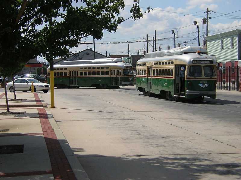
Operator: Philadelphia Transportation Company (PTC)
STREETCAR ROUTES
| 6 | Olney Av. - Ogontz Av. - Cheltenham Av. |
| 10 | City Hall - Market Street (subway) - Lancaster Av. - Overbrook |
| 11 | City Hall - Market Street (subway) - Woodland Av. - Darby |
| 13 | City Hall - Market Street (subway) - Chester Av. - Yeadon |
| 15 | Callowhill - Girard Av. - Port Richmond |
| 23 | Bigler St. - 11th St. [Back: 12th St.] - Germantown Av. - Chestnut Hill |
| 34 | City Hall - Market Street (subway) - Baltimore Av. - Angora |
| 36 | City Hall - Market Street (subway) - Lindbergh Blvd. - Elmwood Av. - Eastwick (88th St.) |
| 47 | Wolf St. - [9th St. - 7th St.] [Back: 8th. St.] - 5th St. - Godfrey Av. |
| 50 | Oregon Av. / Ritner St. - 5th St. [Back: 4th. St.] - 5th St. - Wyoming Av. - Rising Sun Av. - Cheltenham |
| 53 | Luzerne St. - Erie Av. - Wayne Av. - Carpenter Lane |
| 56 | Hunting Park Av. - Erie Av. - Torresdale Av. - Cottman Av. |
| 60 | 35th St. - Allegheny Av. - Port Richmond |
| 62 | Yeadon - Darby |
SUBWAY ROUTES
| BR | Broad Street Spur Line | Fairmount - Chinatown - 8th St. Stn. - 15th/16th & Locust |
| BS | Broad Street (Orange) Line | Fern Rock - Olney Av. - Erie Stn. - North Phildelphia Stn. - Girard Stn. - Fairmount - City Hall - Snyder Stn. |
| MF | Market-Frankford Line | 69th St. Terminal - Market St. - City Hall - 8th St. Stn. - Girard St. - Frankford Terminal |
Operator: Port Authority Transit Corporation (PATCO)
SUBWAY ROUTE
| BL | Bridge Line | 15th/16th & Locust - 8th St. Stn. - Benjamin Franklin Bridge - Camden Broadway |
Note that the route abbraviations BR, BS, MF and BL are for the convenience of this site only, and were not used by the operators.
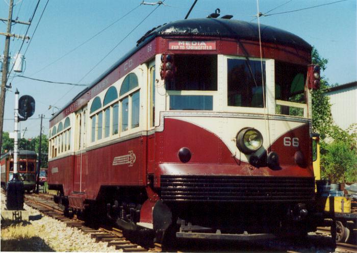
Operator: Philadelphia Suburban Transportation Company (Red Arrow Lines)
LIGHT RAIL ROUTES
| 69th St. Terminal - Radnor - Bridgeport - Norristown | |
| 69th St. Terminal - Ardmore | |
| 69th St. Terminal - Drexel Hill - Springfield - Media | |
| 69th St. Terminal - Drexel Hill - Clifton - Sharon Hill |
CHARACTERISTICS OF THE SYSTEM
NETWORK LENGTH
- Streetcar lines: ? km.
- Light rail lines: ? km.
- Subway lines: ? km.
HISTORY
- Municipal Streetcars: (horse-powered) 26 March 1856 - ca. 1900; (electric) 1 Jan. 1889 - today.
- Fairmount Park Transportation Co. streetcars: 10 Nov. 1896 - 9 Sept. 1946.
- Cable cars: 7 Apr. 1883 - 19 June 1895.
- Light rail (Philadelphia and Western Railroad (P&W)), to Strafford & Norristown): 22 May 1907 - today.
- Light rail (Phil. & West Chester Traction Company; later Philadelphia Suburban Transportation Company (PST)): 1895 - 1896; (electric): 1896 - today.
- Subway: 4 March 1907 - today.
GAUGE
- Streetcars (including Fairmount Park Transportation Co.): 1588 mm.
- Light rail (except Norristown line): 1588 mm.
- Market-Frankford line: 1588 mm.
- Other rapid transit (including Norristown high-speed line): 1435 mm.
SOURCES
- Cox, H.E. Philadelphia car routes. Self-published, 1962.
- Cox, H.E. "The tram subways of Philadelphia [Map]" Modern Tramway & Light Railway Review, June 1963 (26: 306), p.205-214.
- Cox, H.E. "The tram subways of Philadelphia - A history and a forward look" Modern Tramway & Light Railway Review, Jan. 1964 (27: 313), p.24.
- DeGraw, R. "Pig and Whistle: The story of the Philadelphia & Western Ry" Central Electric Railfans' Association Bulletin 2007 (#140).
- DeGraw, R. The Red Arrow. Newtown Square (PA): Haverford Press, 1972.
- Demery, L.W. "US transit funding - Part 6: Elsewhere in the USA (East Coast) [Boston]" Modern Tramway & Light Rail Transit, July 1990 (53: 631), p.225-226.
- Gillham, J. Philadelphia Suburban Transportation map #118. Self-published, 1952.
- Jackson, R.E., Walker, P.J. & Wyse, W.J. "The Lyndenwold Rapid" Modern Tramway & Light Railway Review, July 1970 (33: 391), p.228-236.
- Jenkins, M. "Philadelphia's route 23" Modern Tramway & Light Rail Transit, Aug. 1987 (50: 596), p. 255-262.
- PTC Map of Philadelphia showing street car, bus and subway-elevated lines. Philadelphia: Philadelphia Transportation Company, 1940.
- Simons, V. "A sunny future in Philadelphia" Tramways & Urban Transit, Jan. 2023 (86: 1021), p.10-15.
- Skelsey, G. "A street car named Endure: Rail transit in Philadelphia - Part 1: The city and its character" Tramways & Urban Transit, Jan. 2006 (69: 817), p.10-15.
- Skelsey, G. "A street car named Endure: Rail transit in Philadelphia - Part 2: Heavy rail and SEPTA" Tramways & Urban Transit, Feb. 2006 (69: 818), p.53-55.
- Skelsey, G. "A street car named Endure: Rail transit in Philadelphia - Part 3: Rail transit in Philadelphia" Tramways & Urban Transit, March 2006 (69: 819), p.94-97.
- Szilagyi, M. Montgomery County trolleys. Mount Pleasant (SC): Arcadia Publishing, 2018
- Taplin, M.R. Tramways of North America, including rapid transit [Tramway Handbooks No.4] Hassocks (West Sussex, England): Light Rail Transit Association, 1981.
WIKIS
- Broad Street Line
- Market–Frankford Line
- Norristown High Speed Line
- PATCO Speedline
- Philadelphia and Western Railroad
- River Line (NJ Transit)
- SEPTA
- SEPTA City Transit Division surface routes
- SEPTA Route 15
- SEPTA Route 23
- SEPTA Route 56
- SEPTA Route 103
- SEPTA Routes 101 and 102
- SEPTA Subway–Surface Trolley Lines
WEB SITES
- Fairmount Park Trolley Trail (history and maps) [by David Shaver]
- PATCO (Port Authority Transit Corporation)
- Philadelphia (on UrbanRail.Net)
- Philadelphia trolley tracks
- SEPTA (Southeastern Pennsylvania Transportation Authority)
Special thanks to Russell Powers from Denver CO for information on the history of the Philadelphia system and to Jerry Silverman for pointing out that it is Strafford, not Stafford.
Copyright Gabor Sandi 1998-2026
Disclaimer: Everything on this site was written and/or prepared at the author's discretion. The author has tried to be accurate where facts are presented, but this does not mean that these facts are necessarily accurate. People needing more reliable information should refer to appropriate sources presented, on the Internet or elsewhere, by authoritative professional or academic bodies.
To get in touch with the webmaster, send an e-mail to g_sandi at hotmail.com.
Flags on this site are from the FOTW Flags Of The World website.