VIDEO
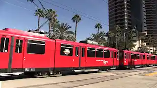 |
| Above: YouTubeCA video - San Diego Trolley in Downtown - Length: 8:08 mins. |
PHOTOS
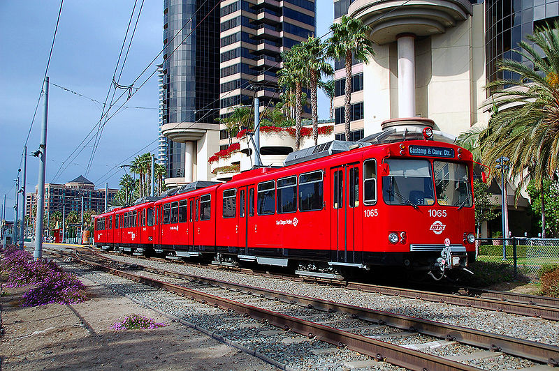 |
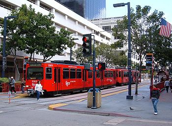 |
MAP
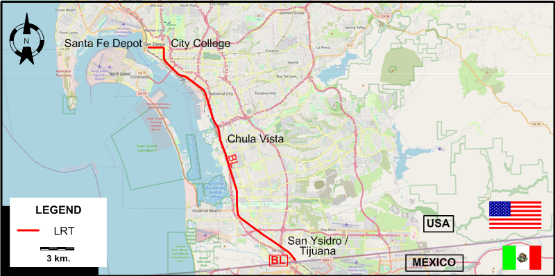
I created the above map by overlaying OpenStreetMap (OSM) maps with my own data. The underlying map data is © OpenStreetMap contributors, licensed under the Open Database License (ODbL).
Please note that the OSM map used as a template for this map corresponds to the situation at the time the map was downloaded and may show features that did not exist at the time the GS Tram Site is supposed to show. In particular, it may show bridges and highways that were built later.
LIGHT RAIL ROUTE
Operator: San Diego Metropolitan Transit System
| San Diego Trolley | Sante Fe Depot – City College – Chula Vista – San Ysidro / Tijuana (US-Mexico border) |
CHARACTERISTICS OF THE SYSTEM
NETWORK LENGTH
- Light rail line: ca. 40 km.
HISTORY
- Horse-trams: 3 July 1886 - ?
- Cable cars: 7 June 1890 - 15 Oct. 1892
- Streetcars: 19 Nov. 1887 - 24 Apr. 1949
- Light rail: 26 July 1981 - today
GAUGE
- Streetcars: 1435 mm. (after 1898); 1067 mm. until 1898
- Light rail: 1435 mm.
TRAM PRESERVATION
The San Diego Vintage Trolley, Inc. restores old San Diego streetcars and hopes to operate them in the future over the regular downtown San Diego Trolley tracks for touristic purposes.
SOURCES
- Mills, J.R. "Ten years of the San Diego trolley: A decade of success in California", Light Rail & Modern Tramway, Jan. 1992 (55:649), p.12-17.
- Rice, W. & Robins, K. "San Diego - Where red LRVs rule", Tramways & Urban Transit, Nov. 1999 (62:743), p.412-414.
- San Diego, California: Street guide & automobile road map. San Diego: San Diego Trust & Savings Bank, ca. 1930 and 1940.
- San Diego street guide. San Diego: San Diego Street Guide Publishers, 1941.
- Simons, V. "San Diego: A US original", Tramways & Urban Transit, Aug. 2013 (76: 908), p.344-347.
- Simons, V. "San Diego expands", Tramways & Urban Transit, March 2022 (85: 1011), p.96-99.
WIKIS
- San Diego Class 1 Streetcars
- San Diego Electric Railway
- San Diego Metropolitan Transit System
- San Diego Trolley
WEB SITES
- MTS: San Diego Trolley
- San Diego (on UrbanRail.Net)
- San Diego Electric Railway Association (SDERA)
- San Diego historic streetcars
Also, thanks to Rob Van Laun of San Diego for his kind corrections of my maps of the original San Diego streetcar network.
Copyright Gabor Sandi 1998-2026
Disclaimer: Everything on this site was written and/or prepared at the author's discretion. The author has tried to be accurate where facts are presented, but this does not mean that these facts are necessarily accurate. People needing more reliable information should refer to appropriate sources presented, on the Internet or elsewhere, by authoritative professional or academic bodies.
To get in touch with the webmaster, send an e-mail to g_sandi at hotmail.com.
Flags on this site are from the FOTW Flags Of The World website.