 |
 |
 |
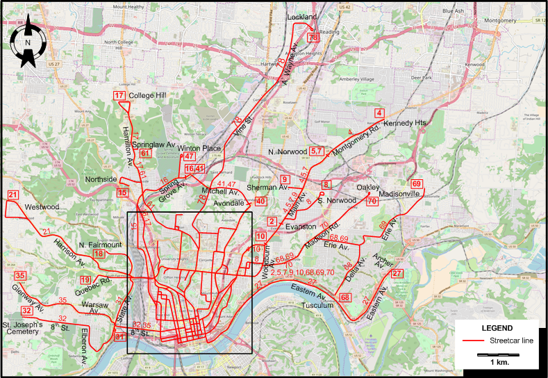
INSET: DOWNTOWN CINCINNATI
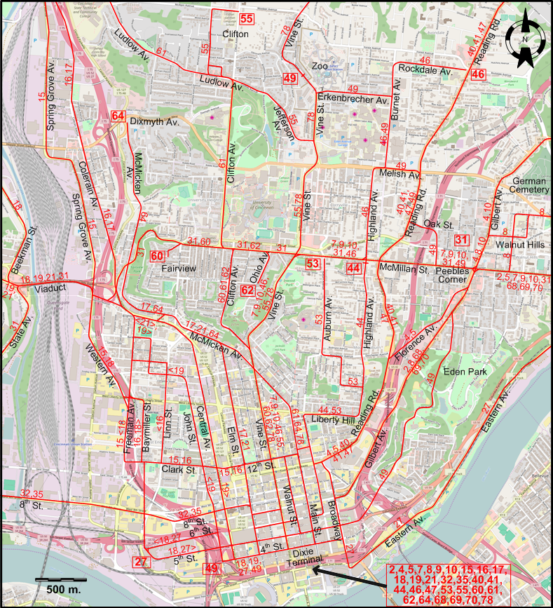
I created the above maps by overlaying OpenStreetMap (OSM) maps with my own data. Copyright on the OSM maps is © OpenStreetMap contributors, licensed under a CC-BY-SA (Creative Commons Attribution-ShareAlike 2.0 licence).
Please note that the OSM maps used as templates for these maps correspond to the situation at the time the maps were downloaded and may show features that did not exist at the time the GS Tram Site is supposed to show. In particular, they may show bridges and highways that were built later.
STREETCAR ROUTES
Operator: Cincinnati Street Railway
| 2 | Evanston | Dixie Terminal - Gilbert Av. - McMillan St. - Woodburn Av. - Main Av. - Evanston |
| 4 | Kennedy Hts. | Dixie Terminal - Reading Rd. - Florence Av. - Gilbert Av. - Main Av. - Montgomery Rd. - Kennedy Hts. |
| 5 | Norwood | Dixie Terminal - Reading Rd. - Florence Av. - Gilbert Av. - Main Av. - N. Norwood |
| 7 | Vine Norwood | Dixie Terminal - Vine St. - McMillan St. - Woodburn Av. - Main Av. - N. Norwood |
| 8 | South Norwood | Dixie Terminal - Gilbert Av. - Walnut Hills - Woodburn Av. - Main Av. - S. Norwood |
| 9 | Vine - Norwood | Dixie Terminal - Vine St. - McMillan St. - Woodburn Av. - Main Av. - Sherman Av. |
| 10 | Vine - Woodburn | Dixie Terminal - Vine St. - McMillan St. - Gilbert Av. - Woodburn Av. - Main Av. (at Blair Av.) |
| 15 | Clark St. | Dixie Terminal - Clark St. - Freeman Av. - Western Av. - Spring Grove Av. - Northside |
| 16 | Colerain | Dixie Terminal - Clark St. - Baymiller St. [back: Linn St.] - Colerain Av. - Spring Grove Av. |
| 17 | College Hill | Dixie Terminal - Elm St. - McMicken Av. - Colerain Av. - Hamilton Av. - College Hill |
| 18 | N. Fairmount | Dixie Terminal - 6th St. [back: 5th St.] - Baymiller St. [back: Freeman Av.] - Western Av. - Viaduct - Beekman St. - N. Fairmount |
| 19 | John St. | Dixie Terminal - John St. [back: Central Av.] - Viaduct - Quebec Rd. |
| 21 | Westwood | Dixie Terminal - Elm St. - McMicken Av. - Central Av. - Viaduct - Harrison Av. - Westwood |
| 27 | East End | 5th & Baymiller - 5th St. [back: 6th St.] - 4th St. - Dixie Terminal - Broadway - Eastern Av. - Archer Av. |
| 31 | Crosstown | 8th St. & State Av. - State Av. - Viaduct - McMillan St. - Peebles Corner |
| 32 | Elberon | Dixie Terminal - 8th St. - Elberon Av. - 8th St. - St. Joseph’s Cemetery |
| 35 | Warsaw Ave. | Dixie Terminal - 8th St. - Warsaw Av. - Glenway Av. |
| 40 | Avondale | Dixie Terminal - Reading Rd. - Avondale |
| 41 | Spring Grove | Dixie Terminal - Reading Rd. - Mitchell Av. - Spring Grove Av. |
| 44 | Highland | Dixie Terminal - Liberty Hill - Highland Av. - McMillan St. |
| 46 | Vine - Burnet | Dixie Terminal - Vine St. - McMillan St. - Highland Av. - Melish Av. - Burnet Av. - Rockdale Av. - Reading Rd. |
| 47 | Winton Place | Dixie Terminal - Reading Rd. - Mitchell Av. - Spring Grove Av. - Winton Place |
| 49 | Zoo - Eden | 4th & John St. - 4th St. - Dixie Terminal - Broadway - Eden Park - Gilbert Av. - McMillan St. - Oak St. - Reading Rd. - Melish Av. - Burnet Av. - Erkenbrecher Av. - Zoo |
| 53 | Auburn | Dixie Terminal - Liberty Hill - Auburn Av. - McMillan St. |
| 55 | Vine - Clifton | Dixie Terminal - Vine St. - Jefferson Av. - Ludlow Av. - Clifton |
| 60 | Fairview | Dixie Terminal - Vine St. - Clifton Av. - McMillan St. - Fairview |
| 61 | Clifton - Ludlow | Dixie Terminal - Main St. - Clifton Av. - Ludlow Av. - Hamilton Av. - Springlaw Av. |
| 62 | Ohio Av. | Dixie Terminal - Vine St. - Clifton Av. - McMillan St. - Ohio Av. |
| 64 | McMicken - Main | Dixie Terminal - Main St. - McMicken Av.- Dixmyth Av. |
| 68 | Madison Rd. | Dixie Terminal - Gilbert Av. - McMillan St. - Madison Rd. - Erie Av. - Delta Av. - Tusculum |
| 69 | Madisonville | Dixie Terminal - Gilbert Av. - McMillan St. - Madison Rd. - Erie Av. - Madisonville |
| 70 | Oakley | Dixie Terminal - Gilbert Av. - McMillan St. - Madison Rd. - Oakley |
| 78 | Lockland | Dixie Terminal - Main St. - Vine St. - Anthony Wayne Av. - Lockland |
CHARACTERISTICS OF THE SYSTEM
NETWORK LENGTH
- Streetcar lines: ca. 300 km.
HISTORY
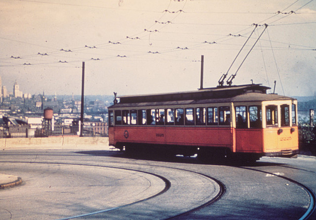
- Horse-drawn streetcars: 14 Sept. 1859 - 1904.
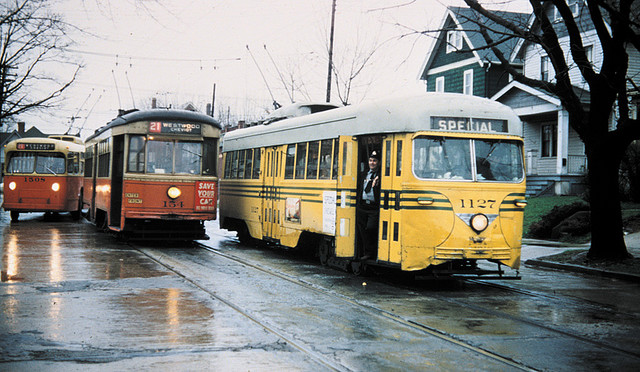
- Electric streetcars (1st generation; dual wiring): 1888 - 29 Apr. 1951.
- Electric streetcars (2nd generation): 9 Sept. 2016 - today.
- Interurbans: 1873 - 1943.
- "Steam dummies" (Steam-operated streetcars): 1860 - 1897
- Cable cars: 17 July 1885 - 9 June 1902.
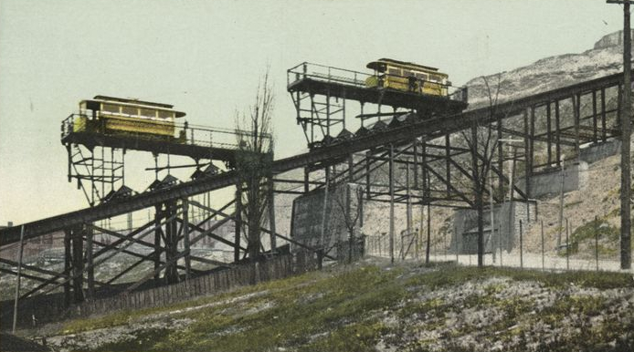
- "Inclined railways" (funiculars carrying streetcars between different levels; powered at first by steam, later by electricity): 1872 - 1948.
GAUGE
- Horse-drawn streetcars: 1588 mm.
- Streetcars (1st generation): 1588 mm.
- Streetcars (2nd generation): 1435 mm.
- Interurbans: 1435 mm., 1588 mm.
SOURCES
- Pence, H. "At last, Cincinnati gets its metals", Tramways & Urban Transit, June 2013 (76: 906), p.256-258.
- Pence, H. & Retallick H. "Re-connecting Cincinnati", Tramways & Urban Transit, Nov. 2016 (79: 947), p.421-425.
- Wagner, R.M. & Wright, R.J. Cincinnati streetcars - No.9: Streamliners and war horses. Wyoming (OH): Trolley Talk, 1984.
WIKIS
- Cincinnati Bell Connector
- Cincinnati Street Railway
- Historical Atlas of Cincinnati: The Relationship Between Transportation and Urban Growth in Cincinnati.
- Southwest Ohio Regional Transit Authority
- Streetcars in Cincinnati
WEB SITES
- Cincinnati Bell Connector
- Cincinnati Traction History
- CINCINNATI-TRANSIT.net
- Cincinnati Transit Historical Association
- Go Metro
- Southwest Ohio Regional Transit Authority (SORTA) Cincinnati Streetcar / Cincinnati Bell Connector
Copyright Gabor Sandi 1998-2026
Disclaimer: Everything on this site was written and/or prepared at the author's discretion. The author has tried to be accurate where facts are presented, but this does not mean that these facts are necessarily accurate. People needing more reliable information should refer to appropriate sources presented, on the Internet or elsewhere, by authoritative professional or academic bodies.
To get in touch with the webmaster, send an e-mail to g_sandi at hotmail.com.
Flags on this site are from the FOTW Flags Of The World website.