VIDEO
 |
| Above: YouTubeCA video - York Corporation Tramways - Length: 3:33 mins. |
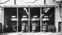
PHOTO
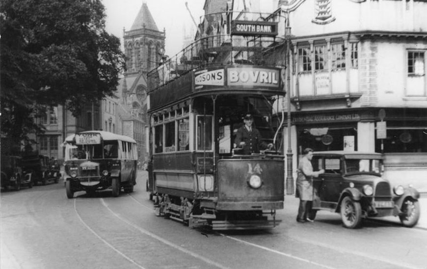 |
MAP
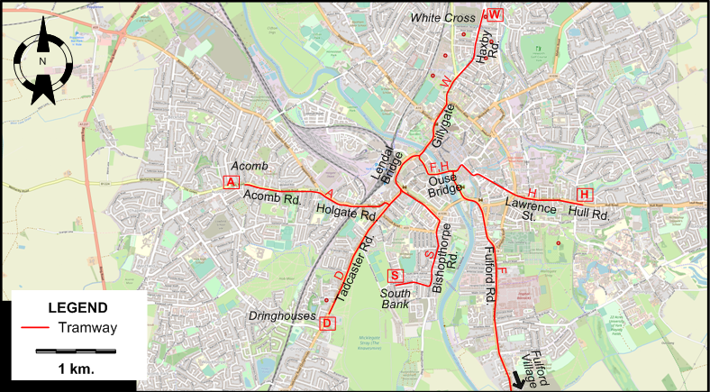
I created the above map by overlaying OpenStreetMap (OSM) maps with my own data. The underlying map data is © OpenStreetMap contributors, licensed under the Open Database License (ODbL).
Please note that the OSM map used as a template for this map corresponds to the situation at the time the map was downloaded and may show features that did not exist at the time the GS Tram Site is supposed to show. In particular, it may show bridges and highways that were built later.
TRAM ROUTES
Operator: York Corporation Tramways
| A | City Centre - Holgate Rd. - Acombe Rd. - Acombe |
| D | City Centre - Tadcaster Rd. - Dringhouses |
| F | City Centre - Ouse Bridge - Fulford Rd. - Fulford Village |
| H | City Centre - Ouse Bridge - Lawrence St. - Fulford Village - Hull Rd. |
| S | City Centre - Bishopthorpe Rd. - South Bank |
| W | City Centre - Lendal Bridge - Gillygate - Haxby Rd. - White Cross |
NB: York tram lines were in general through-routed with other routes and had no terminus in the city centre. The alphabetic route designations used on the map above are for convenience only, and were not used by the operator.
CHARACTERISTICS OF THE SYSTEM
NETWORK LENGTH
- Tramway: 13.5 km.
HISTORY
Tramways
- Horse–powered tramway: 26 Oct. 1880 - 1910.
- Electric tramway: 20 Jan. 1910 - 16 Nov. 1935.
GAUGE
- Horse-powered tramway: 1219 mm.
- Electric tramway: 1067 mm.
SOURCES
- Gillham, J.C. & Wiseman R.J.S. The tramways of West Yorkshire. Broxbourne: Light Transit Association, 2001.
WIKIS
WEB SITES
- A look back at York's original electric-powered public transport (article in The Press [York], 12 June 2014)
Copyright Gabor Sandi 1998-2026
Disclaimer: Everything on this site was written and/or prepared at the author's discretion. The author has tried to be accurate where facts are presented, but this does not mean that these facts are necessarily accurate. People needing more reliable information should refer to appropriate sources presented, on the Internet or elsewhere, by authoritative professional or academic bodies.
To get in touch with the webmaster, send an e-mail to g_sandi at hotmail.com.
Flags on this site are from the FOTW Flags Of The World website.