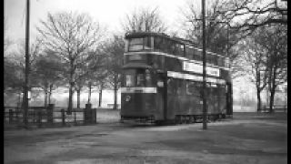
VIDEOS
 |
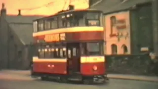 |
| Above: YouTubeCA video - Leeds Trams - Length: 9:40 mins. | Above: YouTubeCA video - Leeds Trams 1958 - Length: 3:20 mins. |
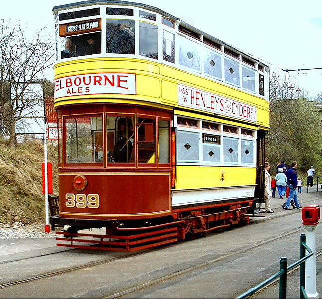
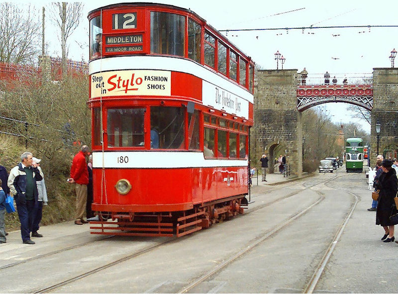
PHOTOS
 |
 |
MAPS
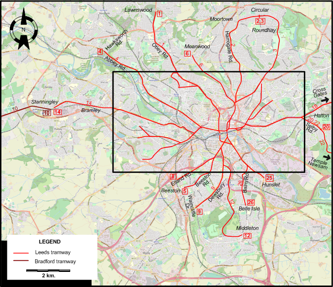
INSET: CENTRAL LEEDS
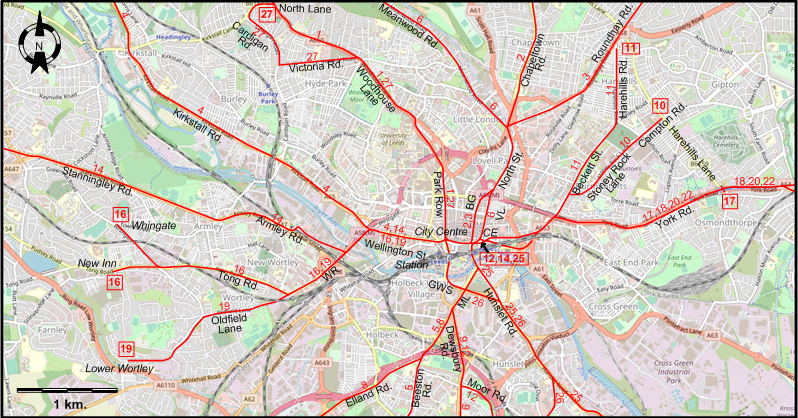
ABBREVIATIONS ON THE MAPS
| BG | Briggate | ML | Meadow Lane |
| CE | Corn Exchange | VL | Vicar Lane |
| GWS | Great Wilson Street | WR | Wellington Rd. |
I created the above maps by overlaying OpenStreetMap (OSM) maps with my own data. The underlying map data is © OpenStreetMap contributors, licensed under the Open Database License (ODbL).
Please note that the OSM maps used as a template for these maps corresponds to the situation at the time the map was downloaded and may show features that did not exist at the time the GS Tram Site is supposed to show. In particular, it may show bridges and highways that were built later.
ROUTES
LEEDS TRAM ROUTES
Operator: Leeds Corporation Tramways
| 1 | City Centre - Park Row - Woodhouse Lane - Otley Rd. - Lawnswood |
| 2 | City Centre - Briggate - North St. - Chapeltown Rd. - Harrogate Rd. - Moortown - Circular |
| 3 | City Centre - Briggate - North St. - Roundhay Rd. - Roundhay - Circular |
| 4 | City Centre - Wellington St. - Kirkstall Rd. - Abbey Rd. - Hawksworth Rd. |
| 5 | City Centre - Meadow Lane - Beeston Rd. - Beeston |
| 6 | City Centre - Vicar Lane - North St. - Meanwood Rd. - Meanwood |
| 8 | City Centre - Meadow Lane - Elland Rd. |
| 9 | City Centre - Meadow Lane - Dewsbury Rd. - Waincliffe Dr. |
| 10 | City Centre - Stoney Rock Lane - Compton Rd. |
| 11 | City Centre - Beckett St. - Harehills Rd. |
| 12 | Corn Exchange - Meadow Lane - Dewsbury Rd. - Moor Rd. - Middleton |
| 14 | Corn Exchange - City Centre - Wellington St. - Wellington Rd. - Armley Rd. - Stanningley Rd. - Bramley - Stanningley |
| 16 | City Centre - Wellington St. - Wellington Rd. - Tong Rd. - Whingate / New Inn |
| 17 | City Centre - York Rd. - Harehills Lane |
| 18 | City Centre - York Rd. - Cross Gates |
| 19 | City Centre - Wellington St. - Wellington Rd. - Oldfield Lane - Lower Wortley |
| 20 | City Centre - York Rd. - Selby Rd. - Halton |
| 22 | City Centre - York Rd. - Selby Rd. - Halton - Temple Newsam |
| 25 | Corn Exchange - Hunslet Rd. - Hunslet |
| 26 | City Centre - Great Wilson Street - Hunslet Rd. - Balm Rd. - Belle Isle |
| 27 | City Centre - Park Row - Woodhouse Lane - Victoria Rd. - Cardigan Rd. - North Lane |
NB: Leeds tram lines were through-routed with each other through the City Centre, and had no formal terminus there.
BRADFORD TRAM ROUTE
Operator: Bradford Corporation Tramways
| 10 | Stanningley - Bradford City Centre |
The above Bradford route is the only one shown on the Leeds map.
CHARACTERISTICS OF THE SYSTEM
NETWORK LENGTH
- Tramways (Leeds): ? km.
HISTORY
Tramways
- Horse–powered tramway: 16 Sept. 1871 - 13 Oct. 1901.
- Steam-operated tramway: 17 June 1880 - 1 Apr. 1902.
- Electric tramway (Leeds): 11 Nov. 1891 (first overhead-trolley electric tramway in Europe) - 7 Nov. 1959.
- Electric tramway (Leeds - Wakefield): 15 Aug. 1904 - 31 May 1932
GAUGE
- Tramways: 1435 mm.
SOURCES
- Gillham, J.C. & Wiseman R.J.S. The tramways of West Yorkshire. Broxbourne: Light Transit Association, 2001.
- King, J.S. "Bradford to Leeds", Modern Tramway and Light Rail Review, June 1969 (32: 378), p.192-201.
- Mellor, G.J. "Tramways in Leeds, 1871 to 1940 - Possibilities of underground working", The Modern Tramway, Sept. 1940 (3: 33), p.104-106.
- Young, A.D. "Leeds trams, 1939-1959 - Part 7: The golden tomorrow", Modern Tramway and Light Rail Review, Jan. 1973 (36: 421), p.5-11.
- Young, A.D. "Leeds trams, 1939-1959 - Part 8: The subways", Modern Tramway and Light Rail Review, Feb. 1973 (36: 422), p.41-48.
- Young, A.D. "Leeds trams, 1939-1959 - Part 9: Frustration", Modern Tramway and Light Rail Review, March 1973 (36: 423), p.79-86.
- Young, A.D. "Leeds trams, 1939-1959 - Part 10: Patch and carry on", Modern Tramway and Light Rail Review, Apr. 1973 (36: 424), p.115-120.
- Young, A.D. "Leeds trams, 1939-1959 - Part 11: The trams recover", Modern Tramway and Light Rail Review, May 1973 (36: 425), p.162-169.
- Young, A.D. "Leeds trams, 1939-1959 - Part 12: Under new management", Modern Tramway and Light Rail Review, June 1973 (36: 426), p.192-197.
- Young, A.D. "Leeds trams, 1939-1959 - Part 13: Nose-dive to bankruptcy", Modern Tramway and Light Rail Review, Aug. 1973 (36: 428), p.264-269.
- Young, A.D. "Leeds trams, 1939-1959 - Part 14: The railcars", Modern Tramway and Light Rail Review, Oct. 1973 (36: 430), p.330-338.
- Young, A.D. "Leeds trams, 1939-1959 - Part 15: Buses for trams", Modern Tramway and Light Rail Review, Nov. 1973 (36: 431), p.366-372.
- Young, A.D. "Leeds trams, 1939-1959 - Part 16: Dismemberment, 1954-1956", Modern Tramway and Rapid Transit Review, Jan. 1974 (37: 433), p.6-13.
- Young, A.D. "Leeds trams, 1939-1959 - Part 17: End of the line", Modern Tramway and Rapid Transit Review, Feb. 1974 (37: 434), p.38-45.
WIKIS
Copyright Gabor Sandi 1998-2026
Disclaimer: Everything on this site was written and/or prepared at the author's discretion. The author has tried to be accurate where facts are presented, but this does not mean that these facts are necessarily accurate. People needing more reliable information should refer to appropriate sources presented, on the Internet or elsewhere, by authoritative professional or academic bodies.
To get in touch with the webmaster, send an e-mail to g_sandi at hotmail.com.
Flags on this site are from the FOTW Flags Of The World website.