 |
 |
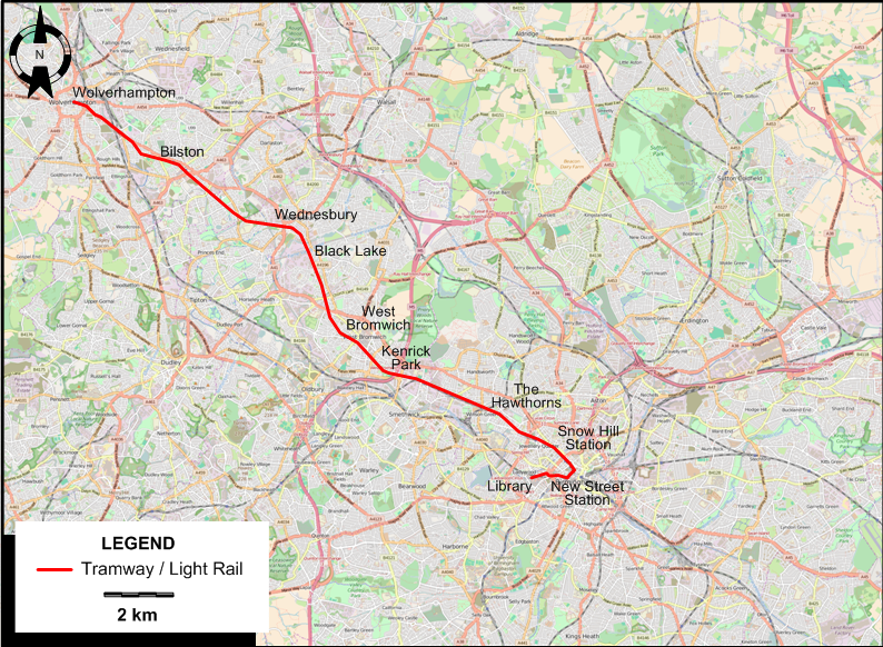
I created the above map by overlaying an OpenStreetMap (OSM) map with my own data. Copyright on the OSM map is © OpenStreetMap contributors, licensed under a CC-BY-SA (Creative Commons Attribution-ShareAlike 2.0 licence).
Please note that the OSM map used as a template for this map corresponds to the situation at the time the map was downloaded and may show features that did not exist at the time the GS Tram Site is supposed to show. In particular, it may show bridges and highways that were built later.
TRAM / LIGHT RAIL ROUTE
Operator: Transport for West Midlands (TfWM) (from 24 June 2018)
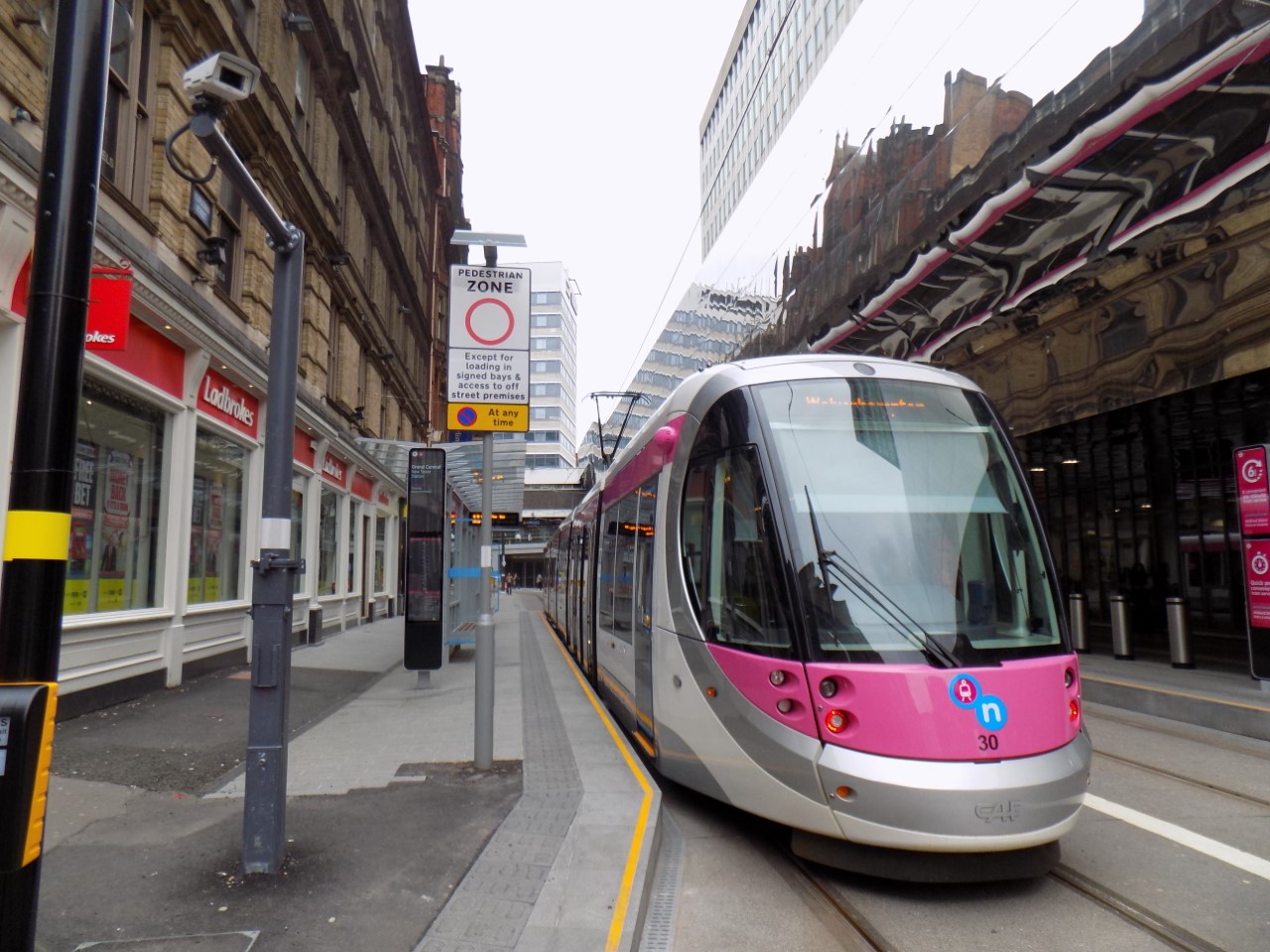
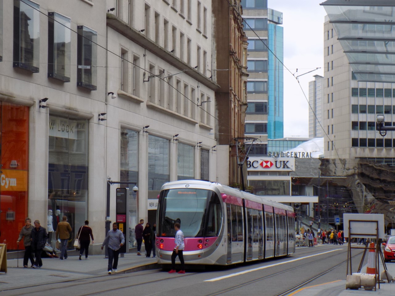
| Midland Metro | Library - New Street Station - Snow Hill Station - The Hawthorns - Kenrick Park - West Bromwich - Black Lake - Wednesbury - Bilston - Wolverhampton |
CHARACTERISTICS OF THE SYSTEM
NETWORK LENGTH
- Tramway: 22 km.
HISTORY
Tramways
- Horse tramways: 20 May 1872 - 1907.
- Steam tramways: 1882 - 31 Dec. 1906.
- Cable tramways: 1888 - 1911.
- First-generation electric tramway: 4 Jan. 1904 - 4 July 1953.
- Revived tramway (Midland Metro): 31 May 1999 - today.
GAUGE
- Tramways (First-generation tramways): 1067 mm.
- Midland Metro: 1435 mm.
SOURCES
- Ballinger, M. "Midland Metro: 'One damn thing after another'" Light Rail & Modern Tramway, July 1995 (58: 691), p.208-210.
- Bett, W.H. & Gillham, J.C. Great British tramway networks. London: Light Railway Transport League, 1962.
- "Birmingham City transport tramway services" The Modern Tramway, Feb. 1946 (9: 97), p.15.
- "Coventry VLR: It’s off the starting blocks", Tramways & Urban Transit, July 2025 (88: 1051), p.253-254.
- Gilbert, C. "Memories of Birmingham's steam trams" Modern Tramway, Apr.-May 1965 (28: 328-329), p.117-127 and 162-170.
- Hewitt, P. & Moreno, A. "Birmingham's 'Big Bang'" Tramways & Urban Transit, July 2017 (80: 955), p.256-261.
- Hewitt, P. & Moreno, A. "Midland Metro to 2030" Tramways & Urban Transit, Sept. 2017 (80: 957), p.335-340.
- Jaques, P. (ed.) Camwell's Birmingham: One man's transport perspective. Droitwich: Birmingham Transport Historical Group, 2007.
- Pulling, N. "Systems Factfile No.189: West Midlands Metro, UK" Tramways & Urban Transit, July 2023 (86: 1027), p.73-277.
WIKIS
- Birmingham Corporation Tramways
- Transport for West Midlands
- Transport in Birmingham
- West Midlands Metro
WEB SITES
Thanks to Urs Mattmann (from Thirsk, England) for the information and photos he kindly sent me concerning the Birmingham system.
Copyright Gabor Sandi 1998-2026
Disclaimer: Everything on this site was written and/or prepared at the author's discretion. The author has tried to be accurate where facts are presented, but this does not mean that these facts are necessarily accurate. People needing more reliable information should refer to appropriate sources presented, on the Internet or elsewhere, by authoritative professional or academic bodies.
To get in touch with the webmaster, send an e-mail to g_sandi at hotmail.com.
Flags on this site are from the FOTW Flags Of The World website.