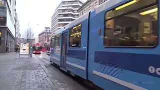
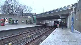
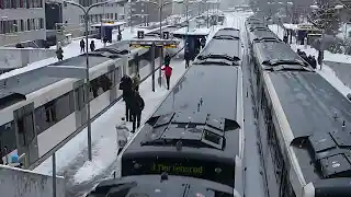
VIDEOS
PHOTOS
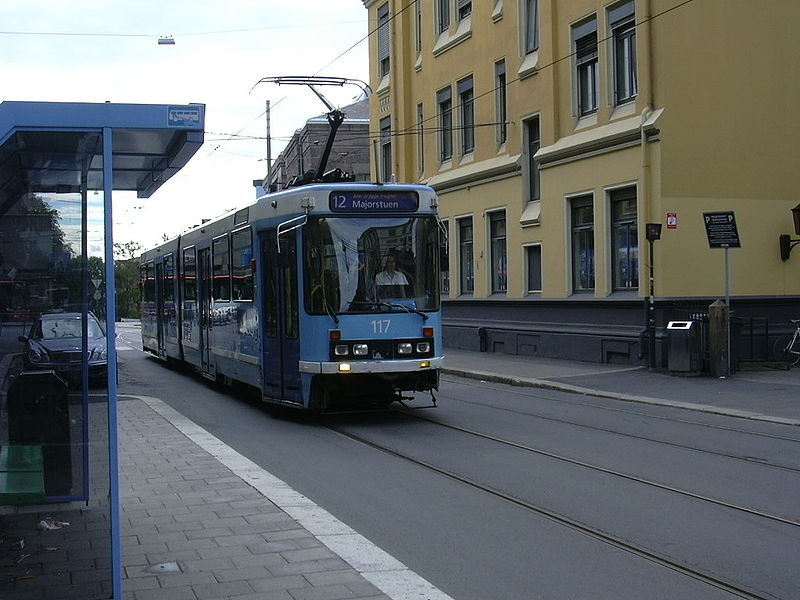 |
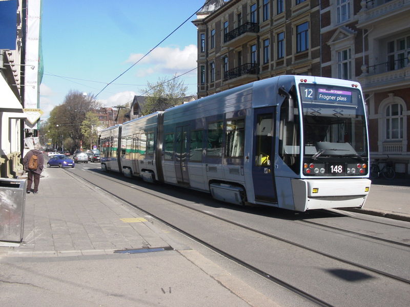 |
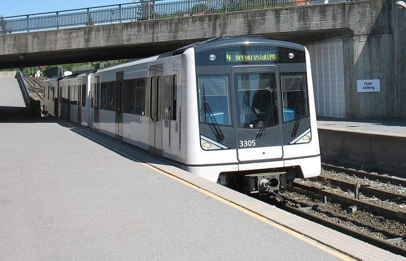 |
MAPS
INSET: CENTRAL OSLO
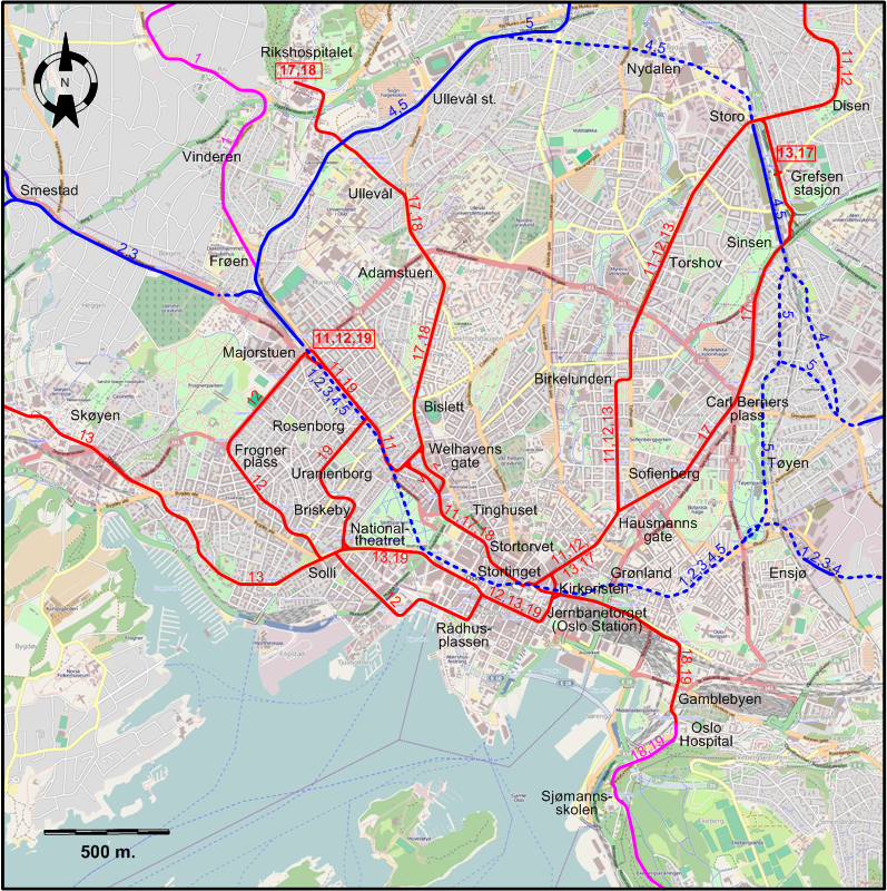
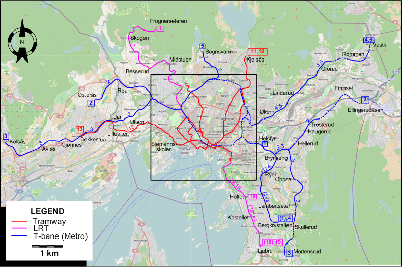
I created the above maps by overlaying OpenStreetMap (OSM) maps with my own data. Copyright on the OSM maps is © OpenStreetMap contributors, licensed under a CC-BY-SA (Creative Commons Attribution-ShareAlike 2.0 licence).
Please note that the OSM maps used as templates for these maps correspond to the situation at the time the maps were downloaded and may show features that did not exist at the time the GS Tram Site is supposed to show. In particular, they may show bridges and highways that were built later.
ROUTES
URBAN TRAM ROUTES
Operator: Sporveien Trikken
| 11 | Majorstuen – Rosenborg – Welhavens gate – Tinghuset – Stortorvet – Kirkeristen – Hausmanns gate – Birkelunden – Torshov – Storo – Disen – Kjelsås |
| 12 | Majorstuen – Frogner plass – Solli – Rådhusplassen – Jernbanetorget (Oslo Station) – Kirkeristen - Hausmanns gate – Birkelunden – Torshov – Storo – Disen – Kjelsås |
| 13 | Bekkestua - Jar - Lilleaker – Ullern – Skøyen – Solli – Nationaltheatret – Jernbanetorget (Oslo Station) – Hausmanns gate – Birkelunden – Torshov – Storo – Grefsen stasjon |
| 17 | Rikshospitalet – Ullevål – Adamstuen – Bislett – Welhavens gate – Tinghuset – Stortorvet – Kirkeristen – Hausmanns gate – Sofienberg – Carl Berners plass – Sinsen – Grefsen stasjon |
| 18 | Rikshospitalet – Ullevål – Adamstuen – Bislett – Welhavens gate – Tinghuset – Stortorvet – Kirkeristen – Gamblebyen – Oslo Hospital – Sjømannsskolen – Holtet – Kastellet – Ljabru [To Holtet only ca. 9 am to 2 pm on weekdays, and ca. noon to 6 pm on Saturdays] [Between Oslo Hospital and Ljabru, operated like a light rail line] |
| 19 | Majorstuen – Rosenborg – Uranienborg – Briskeby – Nationaltheatret – Jernbanetorget (Oslo Station) – Gamblebyen – Oslo Hospital – Sjømannsskolen – Holtet – Kastellet – Ljabru [Between Oslo Hospital and Ljabru, operated like a Light Rail Line] |
T-BANE (UNDERGROUND) ROUTES
Operator: Sporveien Oslo AS
| 1 | Frognerseteren – Skogen – Besserud – Midstuen – Vinderen – Frøen – Majorstuen – Nationaltheatret – Stortinget – Jernbanetorget (Oslo Station) – Grønland – Tøyen – Ensjø – Helsfyr [Weekdays during the day: Brynseng – Ryen – Lambertseter – Bergkrystallen] |
| 2 | Østerås – Røa - Smestad – Majorstuen – Nationaltheatret – Stortinget – Jernbanetorget (Oslo Station) – Grønland – Tøyen – Ensjø – Helsfyr – Brynseng – Hellerud – Haugerud – Trosterud – Furuset – Ellingsrudåsen |
| 3 | Kolsås - Avløs - Gjønnes - Bekkestua - Jar - Smestad – Majorstuen – Nationaltheatret – Stortinget – Jernbanetorget (Oslo Station) – Grønland – Ensjø – Helsfyr – Brynseng – Oppsal – Skullerud – Mortensrud |
| 4 | Vestli - Rommen - Grorud – Linderud – Økern – Sinsen - Storo - Nydalen – Ullevål st. – Majorstuen – Nationaltheatret – Stortinget – Jernbanetorget (Oslo Station) – Grønland – Tøyen – Ensjø – Helsfyr – Brynseng – Ryen – Lambertseter – Bergkrystallen |
| 5 | Sognsvann - Ullevål st. – Majorstuen – Nationaltheatret – Stortinget – Jernbanetorget (Oslo Station) – Grønland – Tøyen – Carl Berners plass – Sinsen - Storo - Nydalen – Ullevål st. – Majorstuen – Nationaltheatret – Stortinget – Jernbanetorget (Oslo Station) – Grønland – Tøyen - Carl Berners plass – Økern – Linderud – Grorud – Rommen – Vestli [This line follows a complete circle around the centre of Oslo in between its radial segments to and from Sognsvann and Vestli] |
CHARACTERISTICS OF THE SYSTEM
NETWORK LENGTH
- Urban tramways (Oslo): ca. 40 km.
- T-Bane (Metro) [both underground and LRT]: 86 km. (of which the Common Tunnel: 4.8 km)
HISTORY
- Urban tramways: (horse-drawn): 6 Oct. 1875 - 1900; (electric): 2 March 1894 - today.
- Suburban tramways (LRT): 1898 - today.
- T-bane (Metro): 22 May 1966 - today.
GAUGE
- Urban tramways: 1435 mm.
- Suburban tramways (LRT): 1435 mm.
- T-bane (Metro): 1435 mm.
TRAM PRESERVATION
The Sporveismuseet (Oslo Tram Museum) has two locations: one in Majorstuen displays old trams, while the one in Vinterbro (near Tusenfryd, 15 km south of Oslo, under construction) will run trams on a 300m track.
Thanks to Lars Vegard of Oslo for information provided for the Oslo pages.
SOURCES
- Sporveiskart Oslo (Utgave 1987). Oslo: AS Oslo Sporveier, 1987.
- "Systems Factfile: No.14 - Oslo, Norway", Tramways & Urban Transit, Nov. 2008 (71:851), p.427-429.
- Wansbeek, C.J. (with assistance by Andersen, B.) "A key role for Oslo's new tram fleet", Tramways & Urban Transit, Apr. 1998 (61:724), p.140-143.
WIKIS
- Common Tunnel (Fellestunnelen)
- Ekeberg Line
- Furuset Line
- Grorud Line
- History of the Oslo Tramway and Metro
- Holmenkollen Line
- Kolsås Line
- Lambertseter Line
- Oslo Metro / T-banen i Oslo
- Østensjø Line
- Røa Line
- Sognsvann Line
- Sporveien T-banen
- Sporveien Trikken
- Trams in Oslo
WEB SITES
Copyright Gabor Sandi 1998-2026
Disclaimer: Everything on this site was written and/or prepared at the author's discretion. The author has tried to be accurate where facts are presented, but this does not mean that these facts are necessarily accurate. People needing more reliable information should refer to appropriate sources presented, on the Internet or elsewhere, by authoritative professional or academic bodies.
To get in touch with the webmaster, send an e-mail to g_sandi at hotmail.com.
Flags on this site are from the FOTW Flags Of The World website.
