VIDEOS
 |
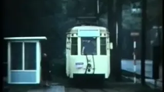 |
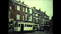
| Above: YouTubeCA video - Ghent trams 1966 - Length: 1:00 min. | Above: YouTubeCA video - Den boerentram in Antwerpen- NMVB nostalgie... - Length: 5:25 mins. |
PHOTOS
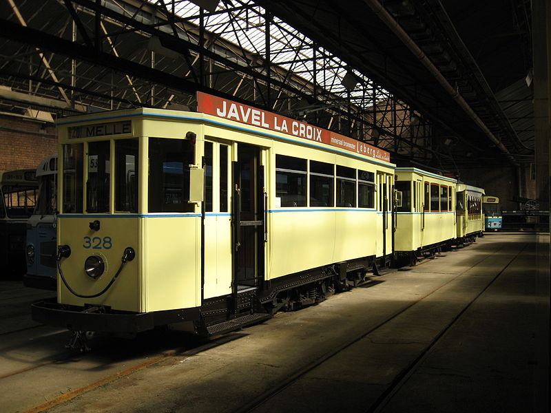 |
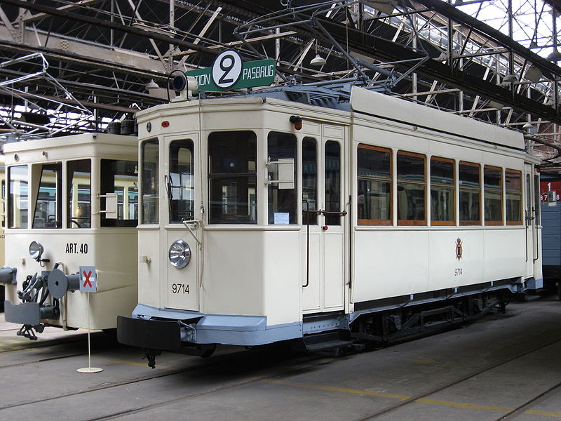 |
MAPS
INSET: EXTENDED GHENT REGION
Only vicinal lines shown
I created the above maps by overlaying OpenStreetMap (OSM) maps with my own data. The underlying map data is © OpenStreetMap contributors, licensed under the Open Database License (ODbL).
Please note that the OSM maps used as a template for these maps corresponds to the situation at the time the map was downloaded and may show features that did not exist at the time the GS Tram Site is supposed to show. In particular, it may show bridges and highways that were built later.
ROUTES
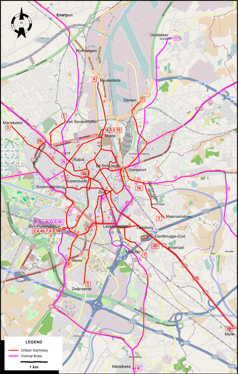
URBAN TRAM ROUTES
Operator: Electrische Tramwegen van Gent (ETG)
| 1 | Moscou - Ledebergplein - Korenmarkt - Zuid - Rabot - Van Beverenplein |
| 2 | Sint-Pietersstation - Rozemarijnbrug - Zuid - Ledeberg - Gentbrugge-Zuid |
| 3 | Mariakerke - Korenmarkt - Bij Sint-Jacob - Dampoort - Meersemdries |
| 3b | Rooigemlaan - Korenmarkt - Bij Sint-Jacob - Dampoort - Gentbruggestraat |
| 4 | Sint-Pietersstation - Korenmarkt - Muide |
| 4b | Sint-Pietersstation - Korenmarkt |
| 5 | Muide - Bij Sint-Jacob - Zuid - Zwijnaarde |
| 6 | Muide - Meulestede |
| 7 | Sint-Pietersstation - Zuid - Dampoort - Darsen |
| 8 | Sint-Pietersstation - Sterre |
| 9 | Sint-Pietersstation - Ledebergplein - Ledeberg - Gentbrugge-Zuid |
| 10 | Sint-Pietersstation - Rozemarijnbrug - Rabot - Muide |
| 20 | Gentbrugge-Zuid - Arsenaal - Melle |
Routes marked b are actually barré (the number with a line drawn across it).
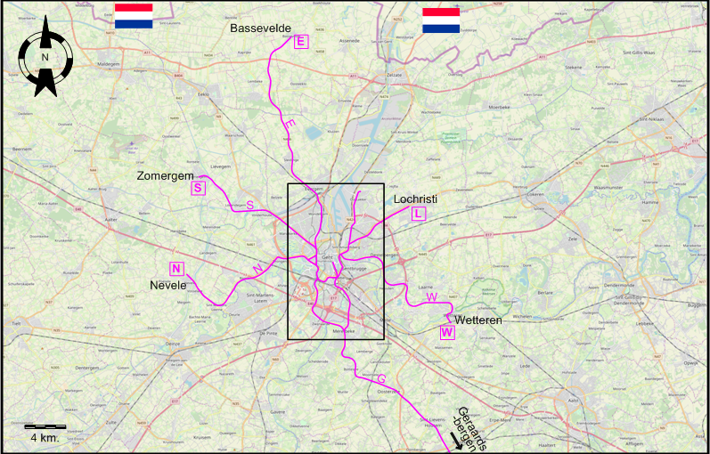
INTERURBAN (VICINAL) TRAM ROUTES
Operator: Société nationale des chemins de fer vicinaux (SNCV) / Nationale Maatschappij van Buurtspoorwegen (NMVB)
| E | Sint-Pietersstation - Rabot - Evergem - Bassevelde* |
| G* | Sint-Pietersstation - Sterre - Zwijnaarde - Merelbeke - Geraardsbergen |
| L | Sint-Pietersstation - Dampoort - Lochristi |
| M | Zuid - Merelbeke |
| N | Sint-Pietersstation / Rabot - Drongen - Nevele |
| O | Sint-Pietersstation - Dampoort - Oostakker |
| S | Sint-Pietersstation - Rabot - Zomergem |
| W | Sint-Pietersstation - Dampoort - Wetteren |
* Routes/served localities marked with an asterisk were not electrified.
Lines M & S, although part of the Vicinal network, were operated by ETG.
CHARACTERISTICS OF THE SYSTEM
NETWORK LENGTH
- Urban trams: 53 km.
- Interurban (Vicinal) trams: ? km.
HISTORY
- Urban trams: (horse-drawn) 24 May 1874 - ?; (battery) 1898 - 1904; (electric) 1 Dec. 1901 - today.
- Interurban trams: (steam) 1887 - 1956; (electric) 1901 - 30 May 1959.
GAUGE
- Trams : 1000 mm.
- Interurban trams (SNCV): 1000 mm.
SOURCES
- Davies, W.J.K. The Vicinal story - Light railways in Belgium, 1885-1991. Scarborough [England]: Light Rail Transit Association, 2nd ed., 2006.
- Koenot, L., Justens, S. & Hamal, T. Tram 2000 - Flash 1996. Bruxelles: Hamal, 1996.
- Pulling, N. "Gent - Expansion and modernisation", Tramways & Urban Transit, Nov. 2008 (71:851), p.423-425.
- Pulling, N. "Systems Factfile No.62 - Ghent, Belgium", Tramways & Urban Transit, Nov. 2012 (75:899), p.423-426.
- Vancraeynest, B.R. "The Gent tramways", Modern Tramway & Light Rail Transit, Jan. 1991 (54: 637), p.11-22.
- Wansbeek, C.J. "Gent: Small but perfectly formed", Tramways & Urban Transit, Jan. 2002 (64:769), p.8-11.
WIKIS
WEB SITES
Copyright Gabor Sandi 1998-2026
Disclaimer: Everything on this site was written and/or prepared at the author's discretion. The author has tried to be accurate where facts are presented, but this does not mean that these facts are necessarily accurate. People needing more reliable information should refer to appropriate sources presented, on the Internet or elsewhere, by authoritative professional or academic bodies.
To get in touch with the webmaster, send an e-mail to g_sandi at hotmail.com.
Flags on this site are from the FOTW Flags Of The World website.