VIDEOS
 |
 |
 |
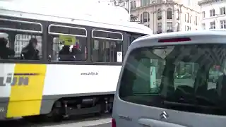
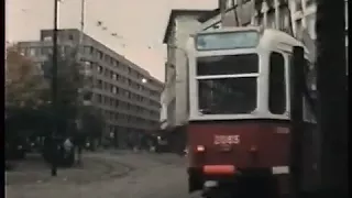
| Above: YouTubeCA video - PCC trams in Antwerp - Length: 6:47 mins. | Above: YouTubeCA video - Antwerp trams (1982) - Length: 3:27 mins. | Above: YouTubeCA video - Trams in Antwerp, Belgium - Antwerpse premetro - Length: 9:21 mins. |
PHOTOS
 |
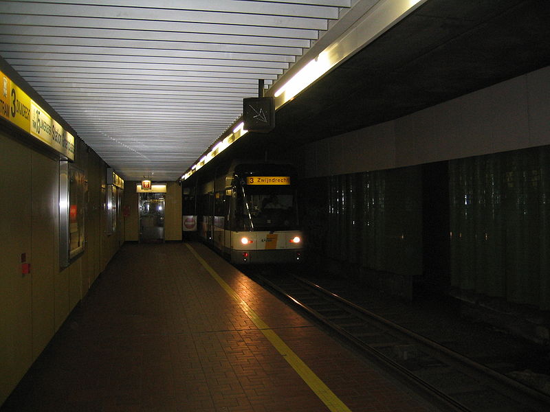 |
MAPS
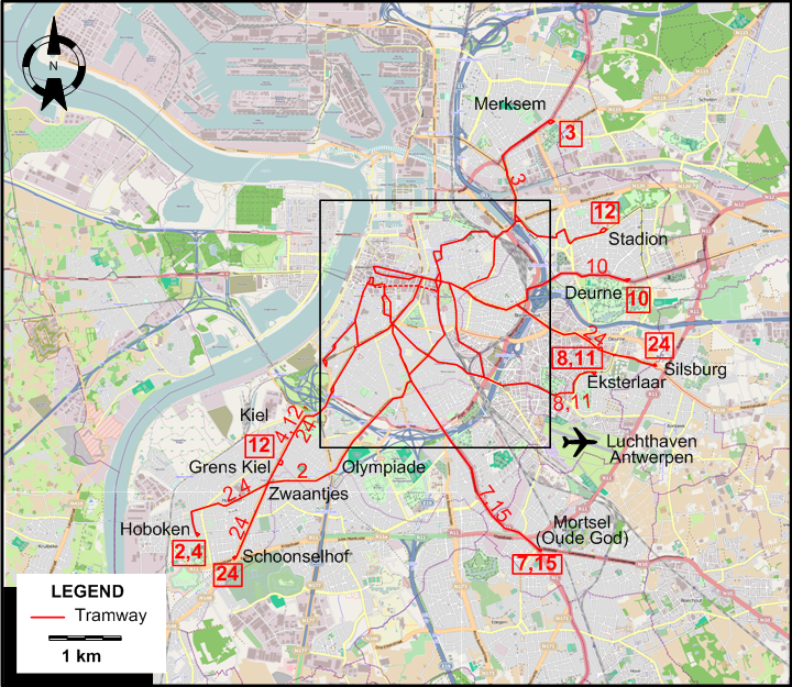
INSET: DOWNTOWN ANTWERP
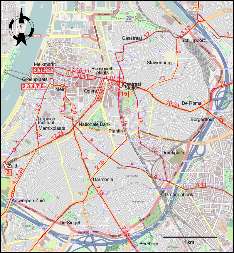
I created the above maps by overlaying OpenStreetMap (OSM) maps with my own data. The underlying map data is © OpenStreetMap contributors, licensed under the Open Database License (ODbL).
Please note that the OSM maps used as a template for these maps corresponds to the situation at the time the map was downloaded and may show features that did not exist at the time the GS Tram Site is supposed to show. In particular, it may show bridges and highways that were built later.
TRAM ROUTES
Operator: Maatschappij vor het Intercommunaal Vervoer te Antwerpen (MIVA)
| 2 | Groenplaats – Pre-Metro (Meir - Opera – Centraal Station) – Plantin – Harmonie – De Singel – Olympiade – Zwaantjes – Hoboken |
| 3 | In 2 sections: (1) Zuid – Tropisch Instituut - Groenplaats (2) Melkmarkt – Rooseveltplaats – Centraal Station - Stuivenberg – Schijnpoort – Merksem |
| 4 | Groenplaats – Tropisch Instituut - Marnixplaats – Antwerpen-Zuid - Kiel – Zwaantjes – Hoboken |
| 7 | Groenplaats – Meir – Nationale Bank – Harmonie – Berchem – Mortsel (Oude God) |
| 8 | Groenplaats – Meir – Nationale Bank – Groenenhoek – Eksterlaar |
| 10 | Melkmarkt – Rooseveltplaats – Centraal Station - De Roma - Borgerhout – Deurne |
| 11 | Melkmarkt – Rooseveltplaats – Centraal Station - Draakplaats – Groenenhoek – Eksterlaar |
| 12 | Stadion – Schijnpoort – Gasstraat - Centraal Station – Rooseveltplaats - Opera – Nationale Bank – Antwerpen-Zuid - Kiel – Grens Kiel |
| 15 | Centraal Station – Plantin – Harmonie – Berchem – Mortsel (Oude God) |
| 24 | Silsburg – Borgerhout – De Roma - Centraal Station – Rooseveltplaats - Opera – Nationale Bank – Kiel – Zwaantjes – Schoonselhof |
CHARACTERISTICS OF THE SYSTEM
NETWORK LENGTH
- Urban trams: ? km.
- Pre-metro (underground tramline): 1.3 km
HISTORY
- Urban trams: (horse-drawn) 1 May 1873 - ?; (electric) 2 Sept. 1902 - today.
- Pre-metro (underground tramline): 25 March 1975 - today.
- Interurban trams: (horse-drawn) 20 July 1879 – 9 Sept. 1908; (steam) 15 Aug. 1885 – 6 March 1932; (electric) 21 June 1908 – 25 May 1968.
GAUGE
- Urban trams: 1000 mm.
- Interurban trams (NMBV): 1000 mm.
SOURCES
- Brosteaux, M. "Antwerpen - A new era", Modern Tramway & Rapid Transit Review, Sept.-Oct. 1975 (38:453-454), p.308-314 and 339-341.
- Davies, W.J.K. The Vicinal story - Light railways in Belgium, 1885-1991. Scarborough [England]: Light Rail Transit Association, 2nd ed., 2006.
- Floyd, J.D.A. "Tramways in Antwerp", The Modern Tramway, March 1949 (12:135), p.56-61.
- Koenot, L., Justens, S. & Hamal, T. Tram 2000 - Flash 1996. Bruxelles: Hamal, 1996.
- Pulling, N. "Systems Factfile No.112 - Antwerp, Belgium", Tramways & Urban Transit, Feb. 2017 (80:950), p.63-68.
- Pulling, N. "Systems Factfile No.216 - Antwerp, Belgium", Tramways and Urban Transit, Oct. 2025 (88:1054), p.389-393.
- Russell, M. "Groenenhoek glory", Tramways & Urban Transit, Apr. 2007 (70:832), p.152-153.
- "Systems Factfile No.32 - Antwerp, Belgium", Tramways & Urban Transit, May 2010 (73:869), p.179-182.
- Wansbeek, C.J. "Antwerpen: 100 years of electric trams", Tramways & Urban Transit, Sept. 2002 (65:777), p.334-337.
WIKIS
WEB SITES
Thanks to Peter Zondag (from Utrecht, The Netherlands), Guy Cools (from Brussels, Belgium) and Ken Van Oproy (from Antwerp, Belgium) for information obtained through personal communication.
Copyright Gabor Sandi 1998-2026
Disclaimer: Everything on this site was written and/or prepared at the author's discretion. The author has tried to be accurate where facts are presented, but this does not mean that these facts are necessarily accurate. People needing more reliable information should refer to appropriate sources presented, on the Internet or elsewhere, by authoritative professional or academic bodies.
To get in touch with the webmaster, send an e-mail to g_sandi at hotmail.com.
Flags on this site are from the FOTW Flags Of The World website.