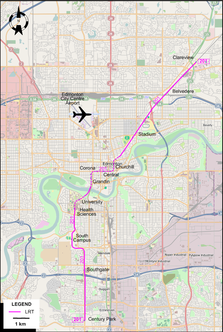
I created the above map by overlaying OpenStreetMap (OSM) maps with my own data. The underlying map data is © OpenStreetMap contributors, licensed under the Open Database License (ODbL).
Please note that the OSM map used as a template for this map corresponds to the situation at the time the map was downloaded and may show features that did not exist at the time the GS Tram Site is supposed to show. In particular, it may show bridges and highways that were built later.
LRT ROUTE
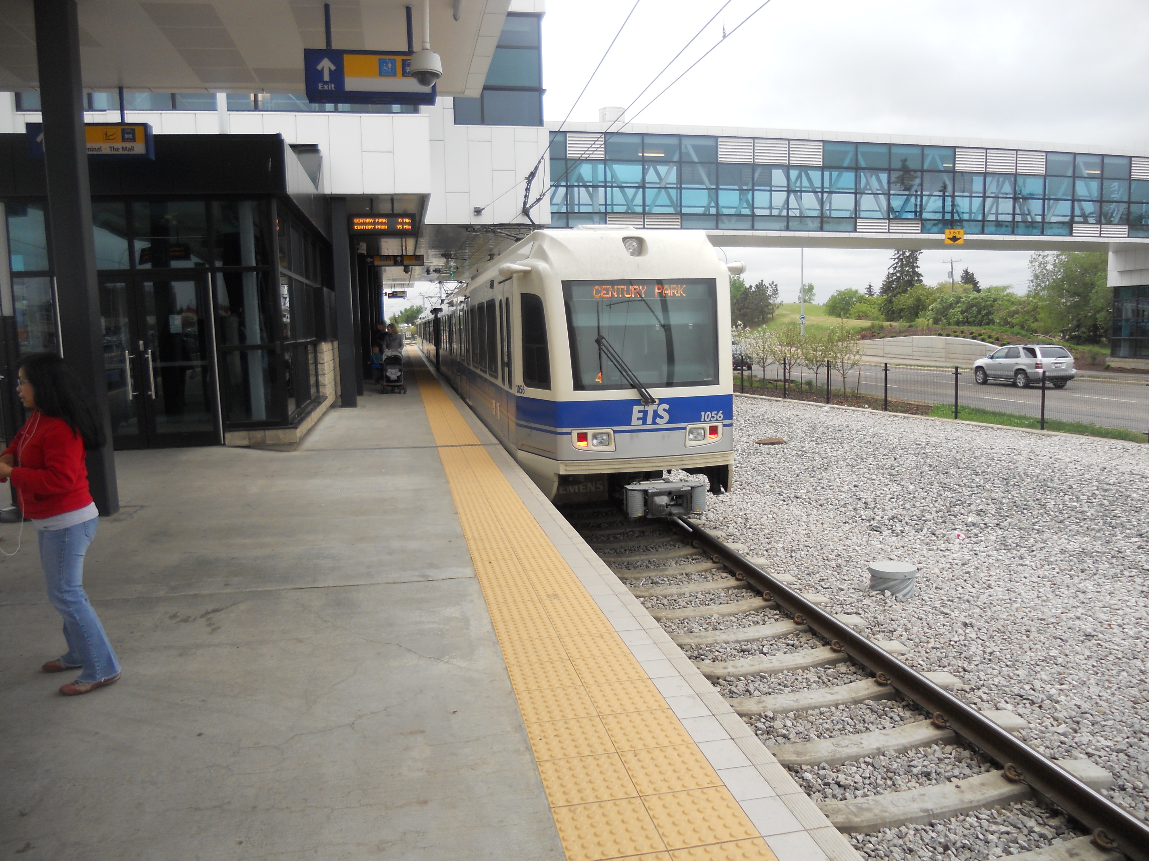
Operator: Edmonton Transit System
| 210 | Clareview - Belvedere - Stadium - Churchill - Central - Corona - Grandin - University - Health Sciences - South Campus - Southgate - Century Park |
Opening dates for line segments:
- 1978 Apr. 22: Belvedere - Central
- 1981 Apr. 26: Belvedere - Clareview
- 1983 June: Central - Corona
- 1989 Sept.: Corona - Grandin
- 1992 Aug. 23: Grandin - University
- 2006 Jan. 1: University - Health Sciences
- 2009 Apr. 25: Health Sciences - South Campus
- 2010 Apr. 24: South Campus - Century Park
CHARACTERISTICS OF THE SYSTEM
NETWORK LENGTH
- 20.5 km.
HISTORY
- Streetcars (Old system): 9 Nov. 1908 - 2 Sept. 1951.
- C-Train (LRT): 23 Apr. 1978 - today.
GAUGE
- 1435 mm.
TRAM PRESERVATION
The Edmonton Radial Railway Society operates heritage streetcars (from Edmonton and elsewhere) over a dedicated restored right-of-way in downtown Edmonton, using tracks on the High Level Bridge, as well as in historic Fort Edmonton Park
.SOURCES
- Hatcher, C.K. & Schwarzkopf, T. Edmonton's electric transit: The story of Edmonton's streetcars and trolley buses. Toronto: Railfare Enterprises, 1983.
- Simons, V. "Driving North American 'Urban Style' LRT", Tramways & Urban Transit, March 2015 (78: 927), p.101-104.
- Simons, V. "Edmonton: A tale of two systems", Tramways & Urban Transit, Nov. 2022 (85: 1019), p.417-420.
- Taplin, M.R. Tramways of North America including rapid transit. Hassocks (West Sussex), England: Light Rail Transit Association, 2nd ed., [1981].
WIKIS
- Edmonton Light Rail Transit
- Edmonton Radial Railway
- Edmonton Radial Railway Society
- Edmonton Transit System
WEB SITES
- Canadian Street Railways
- City of Edmonton - Edmonton Transit Service (ETS)
- Edmonton (on UrbanRail.Net)
- Edmonton Radial Railway Society
Copyright Gabor Sandi 1998-2026
Disclaimer: Everything on this site was written and/or prepared at the author's discretion. The author has tried to be accurate where facts are presented, but this does not mean that these facts are necessarily accurate. People needing more reliable information should refer to appropriate sources presented, on the Internet or elsewhere, by authoritative professional or academic bodies.
To get in touch with the webmaster, send an e-mail to g_sandi at hotmail.com.
Flags on this site are from the FOTW Flags Of The World website.