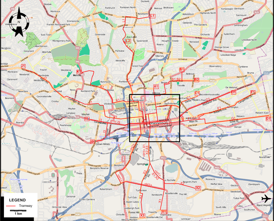
INSET: CENTRAL JOHANNESBURG
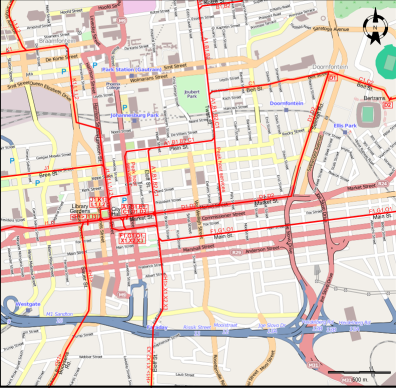
TRAM ROUTES
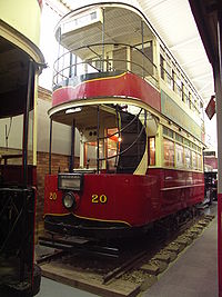
Operator: Johannesburg Transport Department
| A1 |
Twist St. |
City Hall - Market St. - Eloff St. - Plein St. - Twist St. - Hillbrow |
| B1 |
Yeoville |
City Hall - Market St. - Eloff St. - Plein St. - Twist St. - Kotze St. - Raleigh St. - Yeoville |
| B2 |
Observatory |
City Hall - Market St. - Eloff St. - Plein St. - Twist St. - Kotze St. - Raleigh St. - Observatory |
| C1 |
Judith's Paarl |
City Hall - Market St. - Eloff St. - Plein St. - Twist St. - Beit St. - Judith's Paarl |
| D1 |
Marlborough House |
City Hall - Market St. - Seimert Rd. - Doornfontein |
| D2 |
Bertrams |
City Hall - Market St. - Seimert Rd. - Beit St. - Bertrams |
| F1 |
Kensington |
City Hall - Main St. - Roberts Ave. - Langerman Dr. - Kensington |
| G1 |
Malvern |
City Hall - Main St. - Jules St. - Malvern East |
| H1 |
Turffontein |
Library Gardens - Market St. - Sauer St. - Booysens Rd. - Ophirton - Booysens - Turffontein - Rosettenville -
La Rochelle - Springfield - Eloff St. - Market St. - Library Gardens [Circular route, both directions] |
| O1 |
Bezuidenhout Valley |
City Hall - Main St. - Kitchener Ave. - Bezuidenhoutsvallei |
| I1 |
Mayfair |
Library Gardens - Market St. - Central Ave. - Mayfair |
| I3 |
Crown Mines |
Library Gardens - Market St. - Hanover St. - Crown Mines |
| J1 |
Malvern |
City Hall - Harrison St. - Bree St. - Caroline St. - Main Rd. - Newlands (Shortmarket St.) |
| K1 |
Melville |
City Hall - Harrison St. - Braamfontein - Vrededorp - Auckland Park - Melville |
| L1 |
Parktown North |
City Hall - Harrison St. - Braamfontein - Parktown - Forest Town - Jan Smuts Ave. - Zoo Lake - Parktown North - Rosebank |
| L2 |
Zoo Lake |
City Hall - Harrison St. - Braamfontein - Parktown - Forest Town - Jan Smuts Ave. - Zoo Lake |
| X1 |
Rosettenville |
City Hall - Market St. - Eloff St. - Springfield - La Rochelle
- Rosettenville - Townsview |
| X2 |
Regents Park |
City Hall - Market St. - Eloff St. - Springfield - La Rochelle
- Rosettenville - Regents Park |
| X3 |
Forest Hill |
City Hall - Market St. - Eloff St. - Springfield - Turffontein Rd. - Turffontein - Forest Hill |
Note: The line designations X1, X2 and X3 are for the convenience of readers of this site only. I have not been able to determine the actual line designations used by the Johannesburg Transport Department
for these routes.
CHARACTERISTICS OF THE SYSTEM
NETWORK LENGTH
|