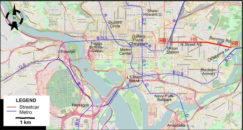
ROUTES
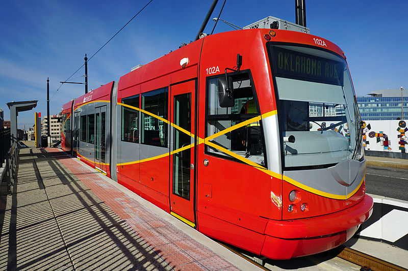
STREETCAR ROUTE
Operator:
RATP
| H Street NE/Benning Road Line (HB) |
Union Station - H Street NE - Benning Rd. NE - Oklahoma Av. NE |
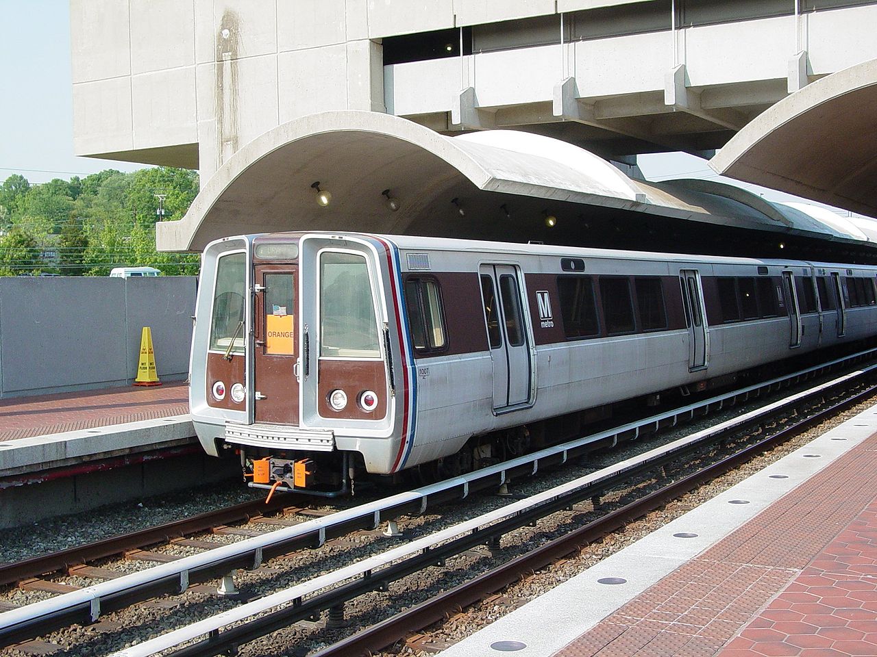
METRO (SUBWAY) ROUTES
Operator:
Washington Metropolitan Area Transit Authority (WMATA)
| B |
Blue Line |
Franconia-Springfield - Ronald Reagan Washington National Airport -
Pentagon - Rosslyn - Foggy Bottom-GWU - Metro Center - L’Enfant Plaza - Stadium-Armory - Largo Town Center |
| G |
Green Line |
Greenbelt - Fort Totten - Shaw-Howard U. - Gallery Place-Chinatown - L’Enfant Plaza -
Navy Park-Ballpark - Anacostia - Branch Ave. |
| O |
Orange Line |
Vienna - East Falls Church - Rosslyn - Foggy Bottom-GWU - Metro Center -
L’Enfant Plaza - Stadium-Armory - New Carrollton
|
| R |
Red Line |
Shady Grove - Bethesda - Woodley Park-Zoo - Dupont Circle - Metro Center -
Gallery Place-Chinatown - Union Station - Rhode Island Ave. - Fort Totten - Glenmont
|
| S |
Silver Line |
Wiehle Reston East - East Falls Church - Rosslyn - Foggy Bottom-GWU - Metro Center -
L’Enfant Plaza - Stadium-Armory - Largo Town Center |
| Y |
Yellow Line |
[Rush hour only: Greenbelt - ] Fort Totten - Shaw-Howard U. - Gallery Place-Chinatown - L’Enfant Plaza -
Pentagon - Ronald Reagan Washington National Airport - Huntington [Rush hour only, also to Franconia-Springfield] |
CHARACTERISTICS OF THE SYSTEM
NETWORK LENGTH
- Streetcars: 3.9 km.
- Metro (Subway): 188 km.
|