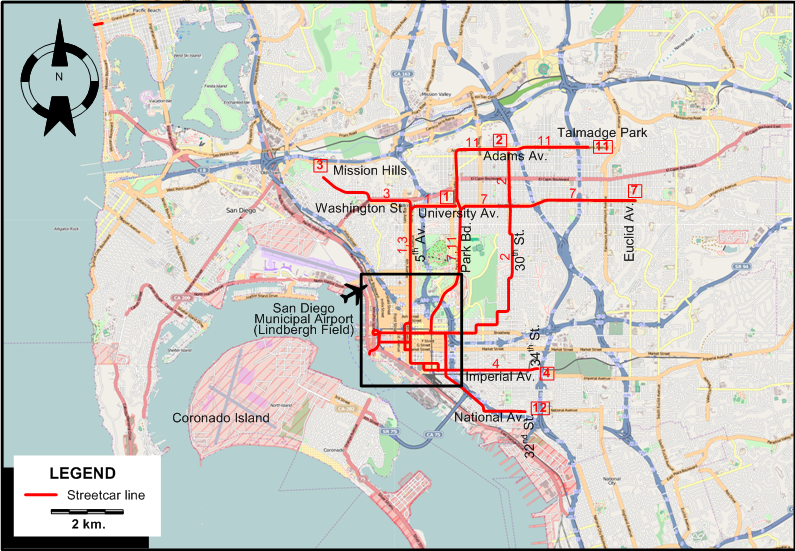
INSET: CENTRAL SAN DIEGO
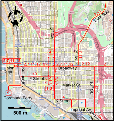
STREETCAR ROUTES
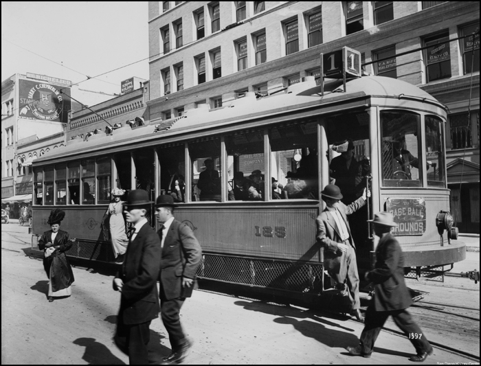
Operator: San Diego Electric Railway (SDERy)
| 1 |
5th & Market - 5th Av. - University Av. - Park Bd. |
| 2 |
Union Depot - Broadway - 30th St. - 30th & Adams |
| 3 |
5th & Market - 5th Av. - Washington St. - Mission Hills |
| 4 |
5th & B Av. - 5th Av. - K Street - Imperial Av. - 34th & Imperial |
| 7 |
Union Depot - Broadway - 12th Av. - Balboa Park - Park Bd. - University Av. - Euclid Av. & University |
| 9 |
Coronado Ferry - Market St. - Kettner Bd. - Broadway - 5th Av. - F Street - Kettner Bd. - Market St. - Coronado Ferry
[Loop route, clockwise] |
| 11 |
Union Depot - Broadway - 12th Av. - Balboa Park - Park Bd. - Adams Av. - Talmadge Park |
| 12 |
Union Depot - Broadway - 16th St. - Logan Av. - National Av. - 32nd St. & National |
CHARACTERISTICS OF THE SYSTEM
NETWORK LENGTH
I am particularly thankful to the staff of the Document Archives at the San Diego History
Center in beautiful Balboa Park, without whose helpful assistance in locating relevant maps and street guides I would not have been able to prepare this page.
|