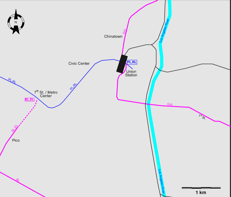
FIRST INSET: DOWNTOWN
LOS ANGELES
SECOND INSET: THE LOS
ANGELES REGION
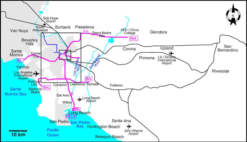
ROUTES
Operator: Los Angeles County
Metropolitan Transportation Authority (Metro)
Note: The two or three-character codes used to
identify routes below and in the maps are for convenience only, and
were not used by the operating company.
LIGHT RAIL ROUTES
Operator: Metro
| BL |
Blue Line |
7th St. / Metro Center –
Pico – Vernon – Firestone – Imperial / Wilmington / Rosa Parks –
Compton – Del Amo – Willow – Long Beach |
| EL |
Expo Line |
7th St. / Metro Center –
Pico – Jefferson / USC - Expo / Western - La Cienega / Jefferson - Culver City - Santa Monica |
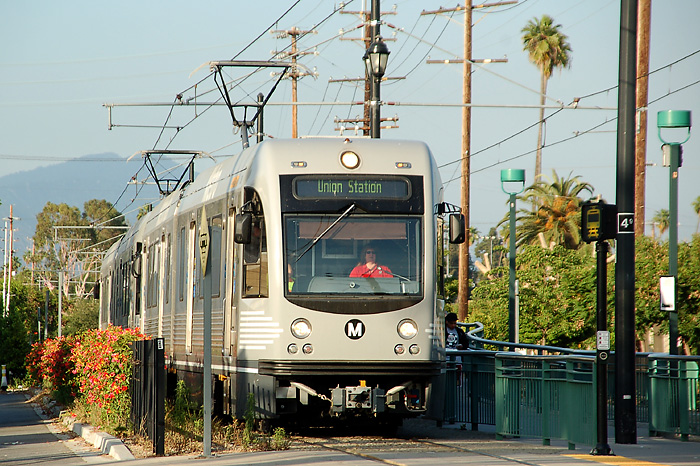
| GoL |
Gold Line |
Atlantic – 3rd St. – 1st St.
– Union Station – Chinatown – Highland Park – South Pasadena – Pasadena
(Sierra Madre Villa) - APU / Citrus College |
| GrL |
Green Line |
Norwalk – Lakewood –
Imperial / Wilmington / Rosa Parks – Vermont – Hawthorne – Aviation/LAX
– Redondo Beach |
SUBWAY ROUTES
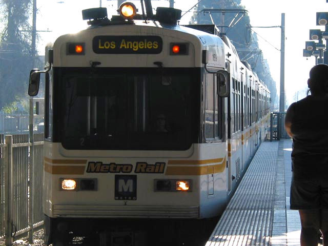
| PL |
Purple Line |
Union Station - Civic Center
- 7th St. / Metro Center - Wilshire / Vermont - Wilshire / Western |
| RL |
Red Line |
Union Station - Civic Center
- 7th St. / Metro Center - Wilshire / Vermont - Vermont / Sunset -
North Hollywood |
CHARACTERISTICS OF THE SYSTEM
NETWORK LENGTH
- LRT lines: 133.1 km.
- Blue Line: 35.4 km.
- Expo Line: 24.5 km.
- Gold Line: 50.0 km.
- Green Line: 32.2 km.
- Subway lines: 25.4 km.
- Purple line (alone): 1.8 km.
- Red line (alone): 17.4 km.
- Purple / Red common line: 6.2 km.
|