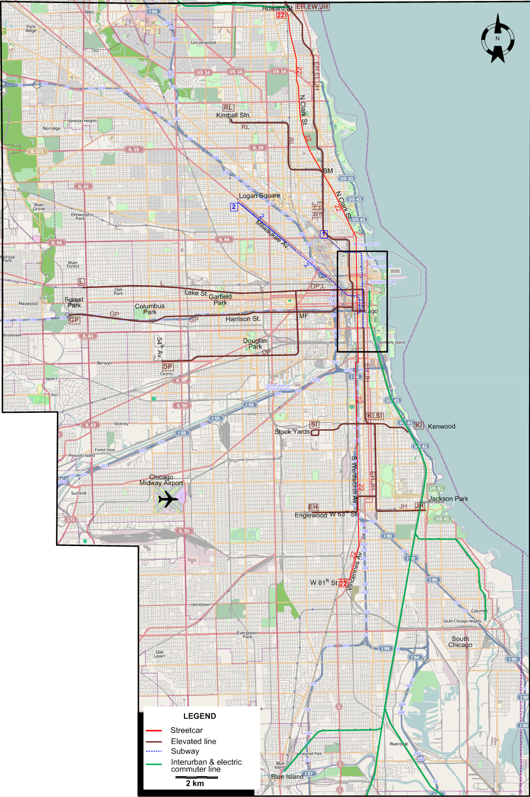
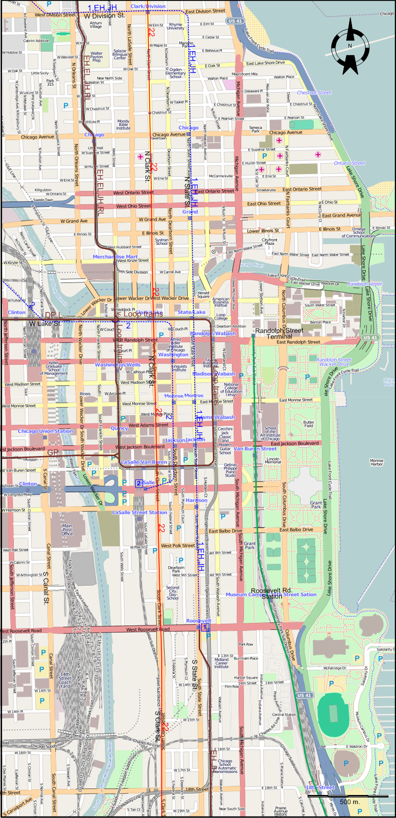
FIRST INSET: DOWNTOWN CHICAGO
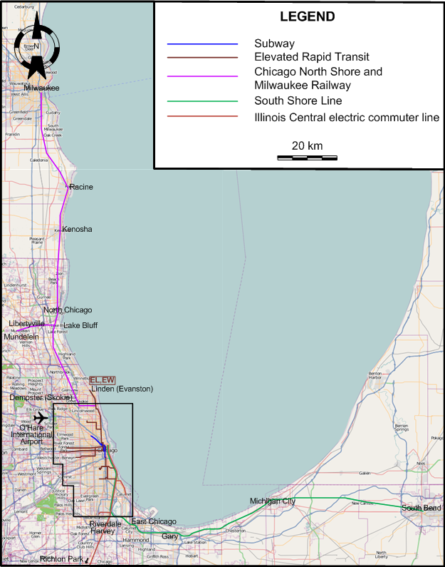
SECOND INSET: INTERURBAN NETWORK AROUND CHICAGO
ABBREVIATIONS ON THE MAPS
| BM |
Belmont Station |
MF |
Marshfield Station |
ROUTES
STREETCAR ROUTE
Operator: Chicago Transit Authority (CTA)
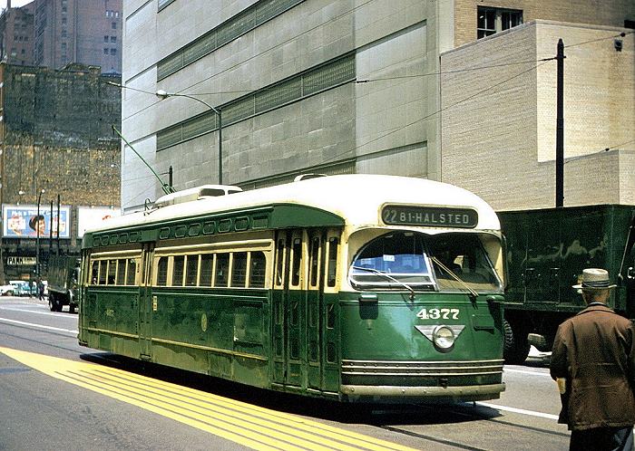
| 22 |
Clark |
Howard St. (City limits) - Clark St. - S Wentworth Av. - Vincennes Av. - W 81st St. & S Halsted St. |
Service discontinuation dates after 31 May 1954 (corresponding route numbers in brackets):
- 1955 June 19: Wabash Av. - Indiana Av. - Cottage Grove Av. (4)
- 1955 Dec. 5: State St. (36)
- 1956 June 17: Western Av. (49)
- 1957 Feb. 18: Broadway; Indiana Av. - S Michigan Av. (36)
- 1957 Sept. 7: Clark St. (22)
- 1958 June 21: Wentworth Av. (22A) [Chicago's last streetcar line]
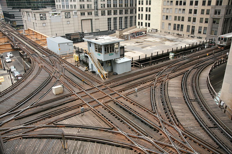
RAPID TRANSIT ROUTES (ELEVATED RAILROADS AND SUBWAYS)
Operator:
Chicago Transit Authority (CTA)
Note: The one and two-character codes used to identify routes below and in the maps are for convenience only, and were not used by the operating company.
| 1 |
State Street Subway |
Roosevelt Rd. - State St. - Division St. - Clybourn Av. - North Av. |
| 2 |
Milwaukee-Dearborn Subway |
La Salle Stn - Dearborn St. - Lake St. - Milwaukee Av. - Damen Stn. - Logan Square |
| DP |
Douglas Park Line |
Loop - (Lake Street Line) - Marshfield - Douglas Park - 54th Av. |
| EH |
Englewood - Howard |
Englewood - Pershing Rd. Station - Roosevelt Rd. - State Street Subway - Belmont - Howard St. |
| EL |
Evanston - Loop |
Linden (Evanston) - Howard St. - Belmont - Pershing Rd. Station - Loop [Rush-hour express service] |
| EW |
Evanston-Wilmette Branch |
Howard Street - Linden (Evanston) [Shuttle] |
| GP |
Garfield Park Line |
Loop - Marshfield - Garfield Park - Columbus Park (Austin) - Forest Park (Des Plaines Av.) |
| JH |
Jackson Park - Howard |
Jackson Park - Pershing Rd. Station - Roosevelt Rd. - State Street Subway - Belmont - Howard Street |
| KI |
Kenwood - Indiana Av. |
Kenwood - Indiana Av. [Shuttle] |
| L |
Lake Street Line |
Loop - Lake Street - Forest Park |
| RL |
Ravenswood - Loop |
Kimball Stn. - Belmont - Loop |
| SI |
Stock Yards - Indiana Av. |
Stock Yards - Indiana Av. [Shuttle] |
INTERURBAN ROUTES
Operator: Chicago North Shore and Milwaukee Railway
| |
Skokie Valley - Mundelein Route |
Chicago - Dempster (Skokie) - Lake Bluff - Libertyville - Mundelein |
| |
Skokie Valley - Milwaukee Route |
Chicago - Dempster (Skokie) - Lake Bluff - North Chicago - Kenosha - Racine - Milwaukee |
Operator: Chicago South Shore and South Bend Railroad
| |
South Shore Line |
Randolph Street Terminal - Roosevelt Rd. Station - 63rd St. Station - Kensington 115th St. - East Chicago - Gary - South Bend |
Service discontinuation dates on interurbans after 31 May 1954:
- 1955 July 24: The Shore Line on the Chicago North Shore and Milwaukee Railroad
- 1957 July 3: : All service on Chicago Aurora & Elgin Railroad (CA&E).
ELECTRIC COMMUTER ROUTES (IC ELECTRIC)
Operator: Illinois Central Railroad
| |
Blue Island Branch |
Randolph Street Terminal - Roosevelt Rd. Station - 63rd St. Station - Kensington 115th St. - Blue Island |
| |
Main Line |
Randolph Street Terminal - Roosevelt Rd. Station - 63rd St. Station - Kensington 115th St. - Riverdale - Harvey - Richton Park |
| |
South Chicago Branch |
Randolph Street Terminal - Roosevelt Rd. Station - 63rd St. Station - South Chicago (E 93rd Street) |
CHARACTERISTICS OF THE SYSTEM
NETWORK LENGTH
- Streetcar lines: ? km.
- Subway: ? km.
- Elevated lines: ? km.
- Interurban lines:
- Chicago North Shore and Milwaukee Railway: 140 km.
- Chicago South Shore & South Bend Railroad: 141 km.
- Electric commuter line (Illinois Central): 46 km.
|