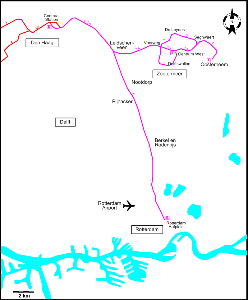
The RandstadRail Light Rapid Rail system, joining The Hague, Rotterdam and nearby smaller municipalties, is shown on a separate map in its entirety.
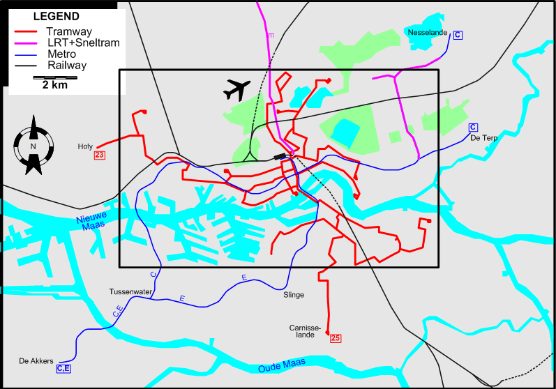
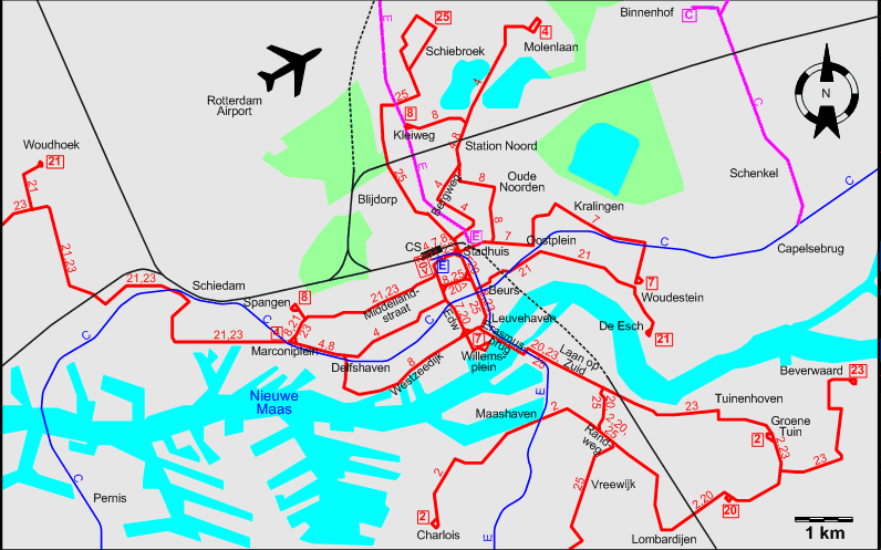
INSET: CENTRAL ROTTERDAM
| CS |
Centraal Station |
HP |
Hofplein |
| Edw |
Eendrachtsweg |
|
|
By-pass the RandStad system map.
THE RANSTADRAIL SYSTEM
Operator: RET
URBAN TRAM ROUTES
| 2 |
Charlois – Maashaven – Lombardijen – Groene Tuin |
| 4 |
Marconiplein – Delfshaven – Centraal Station – Bergweg – Station Noord – Molenlaan |
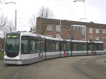
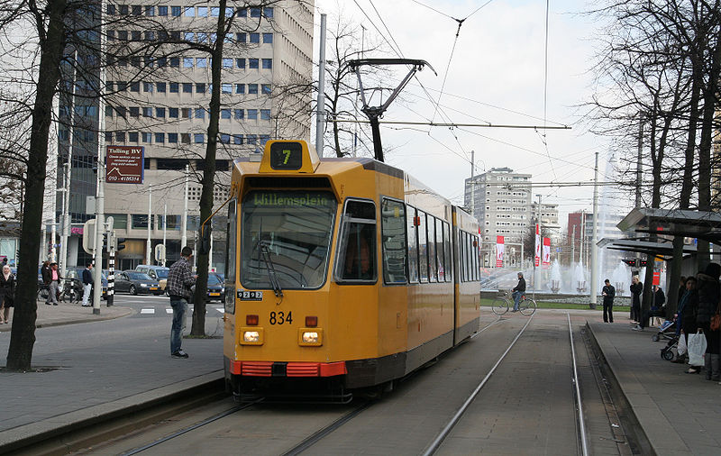
| 7 |
Willemsplein – Centraal Station – Stadhuis – Hofplein – Oostplein – Kralingen – Woudestein |
| 8 |
Spangen – Marconiplein – Delfshaven – Westzeedijk – Leuvehaven – Centraal Station – Stadhuis – Hofplein – Oude Noorden – Station Noord – Kleiweg |
| 20 |
Centraal Station – Eendrachtsweg – Leuvehaven – Erasmusbrug – Laan op Zuid – Randweg – Lombardijen |
| 21 |
De Esch – Woudestein – Oostplein – Centraal Station – Middellandstraat – Marconiplein – Schiedam – Woudhoek |
| 23 |
Beverwaard – Groene Tuin – Tuinenhoven – Laan op Zuid – Erasmusbrug – Leuvehaven – Centraal Station – Middellandstraat – Marconiplein – Schiedam – Holy |
| 25 |
Carnisselande – Vreewijk – Randweg – Laan op Zuid – Erasmusbrug – Leuvehaven – Centraal Station – Blijdorp – Schiebroek |
LIGHT RAIL ROUTE
| E |
Erasmuslijn |
Den Haag Centraal Station – Station Laan van NOI – Leidschenveen – Pijnacker – Berkel en Rodenrijs – Rotterdam Hofplein |
Note: The route designation E is not used by the system itself.
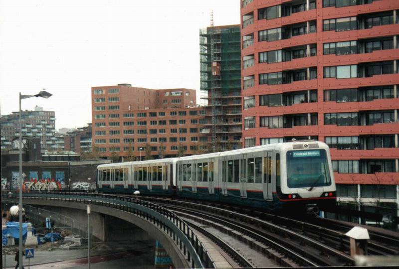
METRO ROUTES
| C |
Calandlijn |
(Nesselande / Binnenhof – Schenkel) / (De Terp) – Capelsebrug – Beurs – Delfshaven – Marconiplein – Schiedam – Pernis – Tussenwater – De Akkers [Including a section of
Sneltram (Fast Tram) in the northeast] |
| E |
Erasmuslijn |
Centraal Station – Beurs – Leuvehaven – Maashaven – Slinge – Tussenwater – De Akkers |
CHARACTERISTICS OF THE SYSTEM
NETWORK LENGTH
- Urban trams: ? km.
- Metro: 55 km. (incl. 8.4 km of Sneltram (Fast Tram))
- LRT lines (shared with The Hague): 68 km.
|