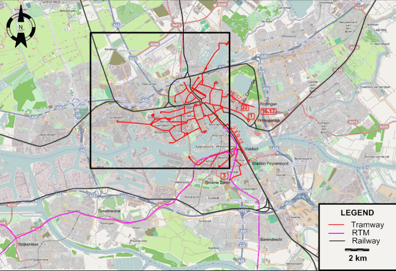
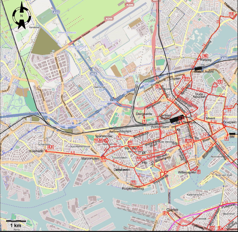
INSET: CENTRAL ROTTERDAM
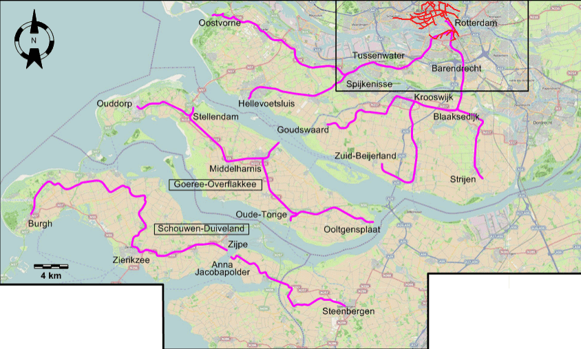
INSET: THE RURAL AREA SOUTH OF ROTTERDAM
| Bs |
Bulgersteyn |
Mp |
Mathenesserplein |
| CdV |
Claes de Vrieselaan |
SM |
Station Maas |
| Edp |
Eendrachtsplein |
Sp |
Stationsplein |
| Hrp |
Heemraadsplein |
St |
Statentunnel |
| Kp |
Kruisplein |
VH |
Van Heusdestraat |
| Ml |
Mathenesserlaan |
|
|
ROUTES
URBAN TRAM ROUTES
Operator: RET
| 1 |
Honingerdijk – Oostplein – Blaak – Coolsingel – Stadhuis – Centraal Station (Back entrance) –
Statentunnel – Beukelsdijk - Aelbrechtsplein |
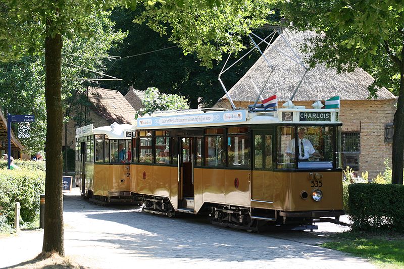
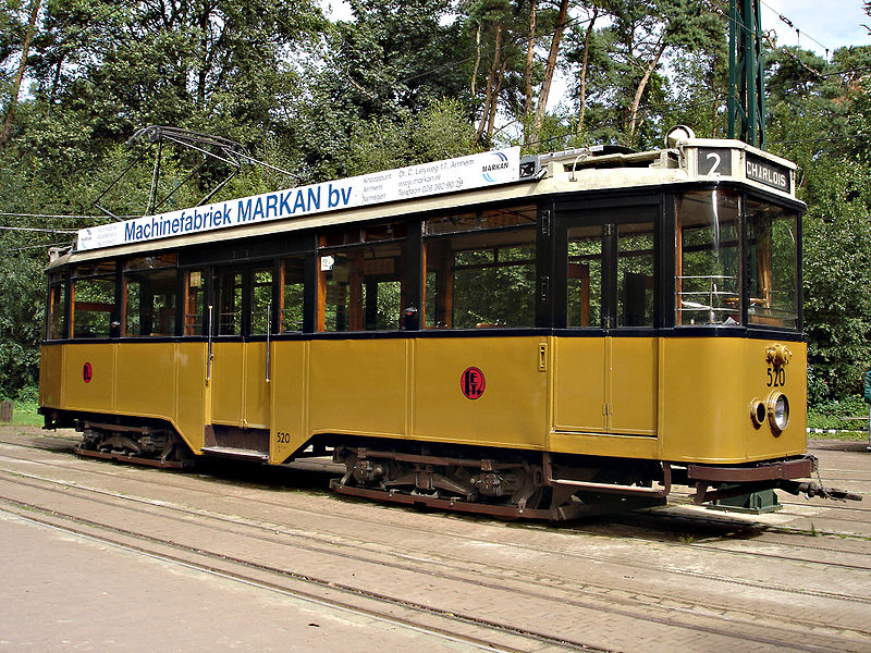
| 2 |
Stationsplein – Coolsingel – Blaak - Bloompjes - Willemsbrug – Viaduct – Putselaan – Charlois |
| 3 |
Diergaarde – Bergselaan - Schieweg - Schiekade - Stadhuis – Coolsingel – Blaak – Willemsbrug – Viaduct – Groene Zoom |
| 4 |
Koemarkt – Marconiplein – Mathenesserplein - Middellandstraat – Kruisplein – Stationsplein – Stadhuis – Meent - Oostplein – Station Maas |
| 5 |
Willemsplein – Eendrachtsweg - Eendrachtsplein – Kruisplein – Stationsplein – Schiekade – Schieweg - Gordelweg |
| 8 |
Bulgersteyn – Eendrachtsplein – Nieuwe Binnenweg – Delfshaven – Marconiplein – Koemarkt |
| 9 |
Stationsplein – Coolsingel – Blaak – Willemsbrug – Viaduct – Lange Hilleweg |
| 10 |
Spartastraat – Marconiplein – Delfshaven – Westzeedijk – Eendrachtsweg - Eendrachtsplein –
Blaak – Meent - Oude Noorden – Station Noord – Kleiweg |
| 11 |
Mathenesserplein – Mathenesserlaan - Nieuwe Binnenweg – Eendrachtsplein – Coolsingel – Stadhuis – Noordsingel – Lisplein |
| 12 |
Bulgersteyn – Blaak - Bloompjes - Willemsbrug – Viaduct – Putselaan – Mijnherenlaan - Pleinweg |
| 14 |
Heemraadsplein – Nieuwe Binnenweg – Eendrachtsplein – Kruisplein –
Stationsplein – Noordsingel – Bergweg – Station Noord – Straatweg - Molenlaan |
| 15 |
Ruigeplaatbrug – Westzeedijk – Claes de Vrieselaan – Middellandstraat – Kruisplein – Stationsplein – Stadhuis – Oude Noorden – Crooswijk |
| 16 |
Spartastraat – Mathenesserplein - Middellandstraat – Kruisplein – Stationsplein – Stadhuis – Oostplein –
Kralingen |
| 17 |
Marconiplein – Delfshaven – Nieuwe Binnenweg – Eendrachtsplein – Blaak – Oostplein – Kralingen |
| 22 |
Van Heusdestraat – Middellandstraat – Statentunnel – Bergweg – Oude Noorden – Av. Concordia |
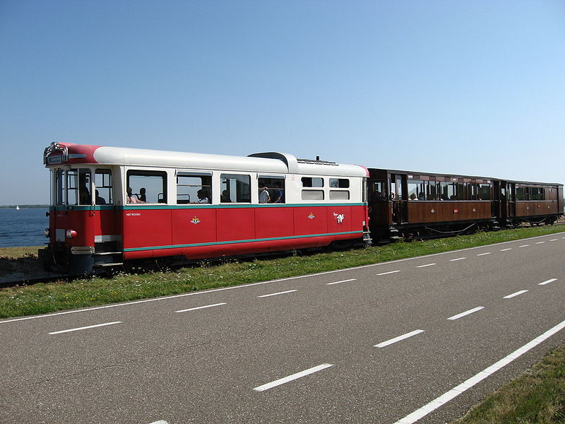
VICINAL TRAM ROUTES
Operator: Rotterdamsche Tramweg Maatschappij (RTM)
| Spijkenisse lines |
Rotterdam - Tussenwater - Spijkenisse - Oostvorne |
| Spijkenisse lines |
Rotterdam - Tussenwater - Spijkenisse - Hellevoetsluis |
| Barendrecht lines |
Rotterdam - Barendrecht - Blaaksedijk - Strijen |
| Barendrecht lines |
Rotterdam - Barendrecht - Blaaksedijk - Krooswijk - Zuid-Beijerland |
| Barendrecht lines |
Rotterdam - Barendrecht - Blaaksedijk - Krooswijk - Goudswaard |
| Goeree-Overflakkee island lines |
Middelharnis - Oude-Tonge - Ooltgensplaat |
| Goeree-Overflakkee island lines |
Middelharnis - Stellendam - Ouddorp |
| Schouwen-Duiveland island line |
Burgh - Zierikzee - Zijpe |
| Sint Philipsland - West-Brabant line |
Anna Jacobapolder - Steenbergen |
CHARACTERISTICS OF THE SYSTEM
NETWORK LENGTH
- Urban trams: ? km.
- Vicinal tram lines: ca. 140 km.
|