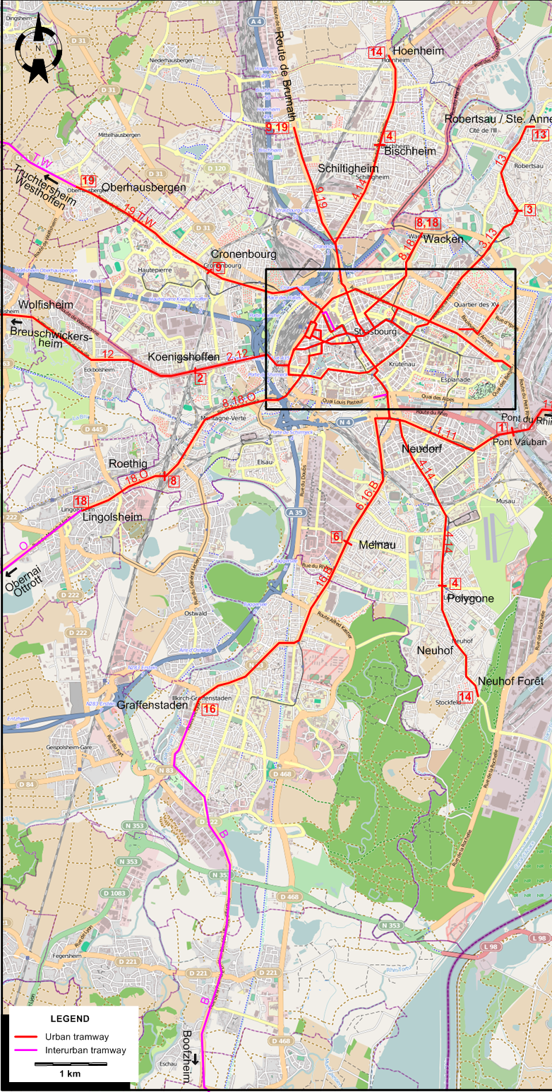
INSET: URBAN STRASBURG
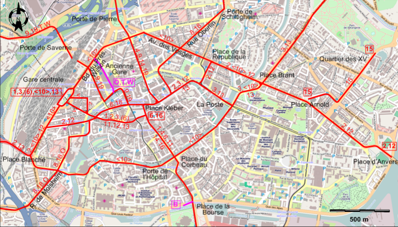
URBAN TRAM ROUTES
Operator: Compagnie des tramways strasbourgeois (CTS)
| 1 |
Gare centrale - Place Kléber - Place du Corbeau - Place de la Bourse - Neudorf - Pont Vauban |
| 2 |
Koenigshoffen - Place Blanche - Place Kléber - Place de la République - Av. des Vosges - Place Brant - Place Arnold - Place d'Anvers |
| 3 |
Gare centrale - Place Kléber - La Poste - Place Brant - Robertsau Église |
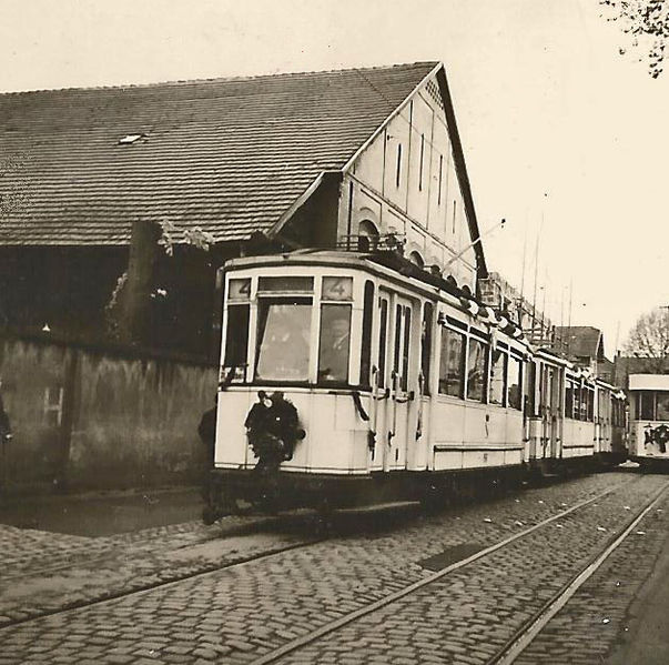
| 4 |
Bischheim - Porte de Pierre - Place Kléber - Place du Corbeau - Place de la Bourse - Neudorf - Polygone |
| 6 |
[At peak times: Gare centrale - ] Place Kléber - Place du Corbeau - Place de la Bourse - Neudorf Ouest -
Meinau |
| 7 |
Breuschwickersheim - Wolfisheim - Koenigshoffen - Place Blanche - Place Kléber - ... |
| 8 |
Wacken - Porte de Schiltigheim - Rue Oberlin - Place Kléber - R. de Molsheim - Roethig |
| 9 |
Route de Brumath - Schiltigheim - Porte de Pierre - Place Kléber - Porte de Saverne - Cronenbourg |
| 10 |
Gare centrale - Bd. du Président Wilson - Av. des Vosges - Place de la République - Av. des Vosges - Place Brant -
Place du Corbeau - Porte de l’Hôpital - Place Blanche - Gare centrale [Circular route, both directions] |
| 11 |
Gare centrale - Place Kléber - Place du Corbeau - Place de la Bourse - Neudorf - Pont Vauban - Pont du Rhin |
| 12 |
Breuschwickersheim - Wolfisheim - Koenigshoffen - Place Blanche - Place Kléber - Place de la République - Av. des Vosges - Place Brant - Place Arnold - Place d'Anvers |
| 13 |
Gare centrale - Place Kléber - La Poste - Place Brant - Robertsau Église - Robertsau / Ste Anne |
| 14 |
Hoenheim - Bischheim - Porte de Pierre - Place Kléber - Place du Corbeau - Place de la Bourse - Neudorf - Polygone -
Neuhof - Neuhof Forêt |
| 15 |
Place Arnold - Quartier des XV |
| 16 |
Place Kléber - Place du Corbeau - Place de la Bourse - Neudorf Ouest -
Meinau - Graffenstaden |
| 18 |
Wacken - Porte de Schiltigheim - Rue Oberlin - Place Kléber - R. de Molsheim - Roethig - Lingolsheim |
| 19 |
Route de Brumath - Schiltigheim - Porte de Pierre - Place Kléber - - Porte de Saverne - Cronenbourg - Oberhausbergen |
INTERURBAN TRAM ROUTES
Operator: Compagnie des tramways strasbourgeois (CTS)
| B |
Strasbourg (Place de la Bourse) - Graffenstaden - Erstein (branch to Erstein gare) - Boofzheim (branch to Rhinau) |
| O |
Strasbourg (Ancienne Gare) - Gare centrale - R. de Molsheim - Roethig - Lingolsheim - Obernai - Ottrott |
| T |
Strasbourg (Ancienne Gare) - Porte de Saverne - Cronenbourg - Oberhausbergen - Dingsheim - Truchtersheim |
| W |
Strasbourg (Ancienne Gare) - Porte de Saverne - Cronenbourg - Oberhausbergen - Dingsheim - Westhoffen |
The interurban route designations B, O, T and W are used for convenience only, and were not used by the operator.
NETWORK LENGTH
- Urban tramway: ca. 80 km.
- Interurban tramways:
- Strasbourg - Boofzheim line: 33 km. (of which about 7 km. shared with the urban network) (+ Erstein branch: 3.2 km., Boofzheim - Rhinau branch: 2 km.)
- Strasbourg - Ottrott line: 34.7 km. (of which 7 km. shared with the urban network)
- Strasbourg - Dingsheim: 6.5 km. line: 15 km. (of which 5.2 km. shared with the urban network)
- Dingsheim - Truchtersheim: 8.5 km.
- Dingsheim - Westhoffen: 21 km.
|