

I created the above map by overlaying an OpenStreetMap (OSM) map with my own data. Copyright on the OSM map is ©
OpenStreetMap & Contributors, licensed under a CC-BY-SA (Creative Commons Attribution-ShareAlike 2.0 licence).
Please note that the OSM map used as a template for this map corresponds to the situation at the time the map was downloaded and may show features that did not exist at the time
the GS Tram Site is supposed to show. In particular, it may show bridges and highways that were built later.
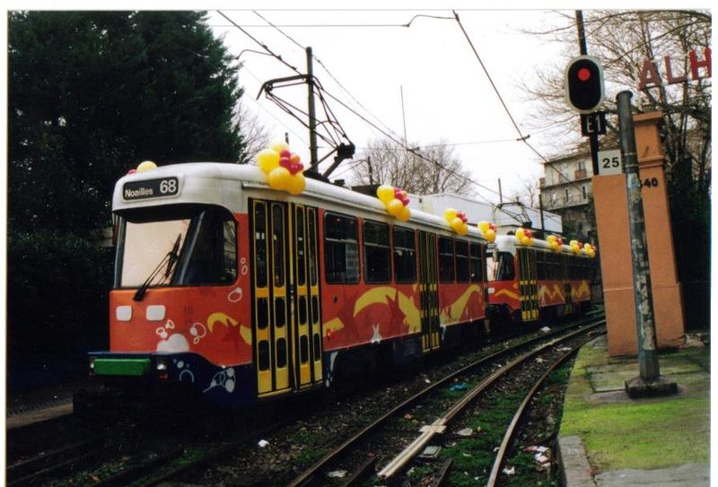
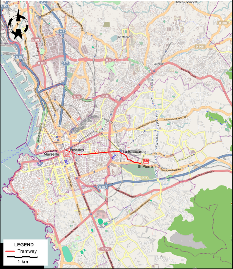
Operator: Régie des transports de Marseille (RTM)
TRAM ROUTE
| 68 |
Noailles - La Blancarde - St. Pierre |
NETWORK LENGTH
HISTORY
- Horse tramway: 21 Jan. 1876 - 1903?
- Steam tramway: 1891 - 1904.
- Urban electric tramway: May 1892 - today.
- Interurban electric tramway: 13 Aug. 1903 - 1948.
- Metro: 26 Nov. 1977 - today.
GAUGE
- Tramways (horse trams and first-generation electric): 1430 mm.
- Tramways (second-generation electric): 1435 mm.
- Metro: 1435 mm.
PRINT
- Jackson, A.A. "The tramways of Marseille", The Modern Tramway, June 1950 (13: 150), p.134-139.
- Laupiès, J. & Martin, J. Les tramways de Marseille ont cent ans Marseille: P. Tacussel, 1990.
- Malterre, P. "The tramways of Marseille today", Modern Tramway & Light Railway Review, May 1963 (26: 305), p.160-163.
- Pulling, N. "Systems Factfile No.41 - Marseille, France", Tramways & Urban Transit, Feb. 2011 (74: 878), p.59-62.
- Wansbeek, C.J. "Light rail the key to mobility in Marseille", Tramways & Urban Transit, Dec. 1999 (62: 744), p.455-458.
- Wansbeek, C.J. "Marseille - Two new tramlines, another French light rail triumph", Tramways & Urban Transit, Oct. 2007 (70: 838), p.377-380.
WIKIS
WEB SITES
|