THE GS TRAM SITE

VANCOUVER

BRITISH COLUMBIA, CANADA

flag.can

1955


CANADA

CALGARY

EDMONTON

MONTRÉAL

OTTAWA

TORONTO

VANCOUVER

VICTORIA


GS Web Site Home


Vancouver tram map 1955


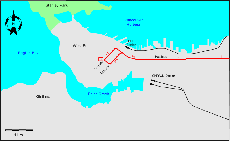
INSET: DOWNTOWN VANCOUVER

Vancouver tram map 1955


ROUTES

Operator: British Columbia Electric Railway Company (BCER)

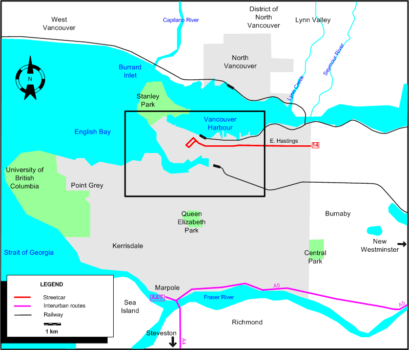
URBAN STREETCAR ROUTES (VANCOUVER)

14 Robson - Richards (back: Granville) - Hastings - Kootenay Loop

The last day of operation of streetcars in Vancouver was 21 April 1955.

INTERURBAN ROUTES

A4 Marpole - Richmond - Steveston
A5 Marpole - New Westminster

The last days of operation of interurbans in the Vancouver area were:

  • A4: 28 February 1958.
  • A5: 17 Nov. 1956.


CHARACTERISTICS OF THE SYSTEM

NETWORK LENGTH

  • Vancouver streetcar lines: ? km.
  • Interurban lines: ? km.


HISTORY

  • Vancouver streetcars: (electric) 28 June 1890 - 21 Apr. 1955.
  • North Vancouver streetcars: (electric) 1 Sept. 1906 - 23 Apr. 1947.
  • Interurban trams: (electric) 3 June 1891 - 28 Feb. 1958.
  • SkyTrain (automated LRT): 3 Jan. 1986 - today.
  • Canada Line (Metro): 17 Aug. 2009 - today.

GAUGE

  • Vancouver and North Vancouver streetcars: 1453 mm.
  • SkyTrain / Canada Line: 1435 mm.

TRAM PRESERVATION

The Transit Museum Society runs vintage interurban streetcars between Granville Island and Science World on weekends and holidays during the summer months. A demonstration service by modern trams from Europe was run on the same line during the 2010 Winter Olympics held in Vancouver.


SOURCES

PRINT

  • Cockle, D. "Tram-train community rail for Fraser Valley", Tramways & Urban Transit, Dec. 2010 (73: 876), p.465-466.
  • Conn, H. & Ewert, H. Vancouver's glory years: Public transit 1890-1915. North Vancouver: Whitecap Books, 2003.
  • "End of city trams in Vancouver" (news item), The Modern Tramway, July 1955 (18:211), p.142.
  • Ewert, H. The perfect little street car system. North Vancouver: North Vancouver Museum and Archives Commission, 2000.
  • Ewert, H. The story of the B.C. Electric Railway Company. North Vancouver: Whitecap Books, 1986.
  • Simons, V. "Vancouver prepares for the Winter Olympics", Tramways & Urban Transit, Jan. 2010 (73: 865), p.11-13.
  • Transit System Map of Vancouver, B.C. [Vancouver]: Challengers Cartographers, 1949, 1952 and 1954.

WIKIS

WEB SITES


Hit count for the GS Tram Site:

Valid HTML 4.01!


Copyright Gabor Sandi 1998-2012

To get in touch with the webmaster, send an e-mail to g_sandi@hotmail.com

Flags on this site are from the FOTW Flags Of The World website.