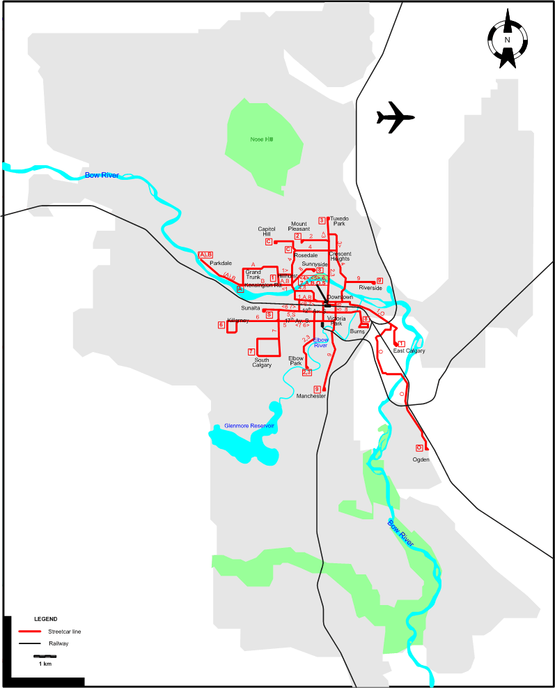
ROUTES
Operator: Calgary Municipal Railway
URBAN STREETCAR ROUTES
| 1 |
Hillhurst - Downtown – East Calgary |
| 2 |
Mount Pleasant – Crescent Heights - Downtown – Elbow Park |
| 3 |
Tuxedo Park – Crescent Heights - Downtown – Elbow Park |
| 4 |
Downtown – Crescent Heights - Rosedale - Hillhurst - Downtown [Circular route, both directions] |
| 5 |
Downtown – 12th Av. S. - 17th Av. S. - Victoria Park - Downtown [Circular route, both directions] |
| 6 |
Downtown – 12th Av. S. [back: 17th Av. S.] - Killarney |
| 7 |
Downtown – 17h Av. S. [back: 12th Av. S.] - South Calgary |
| 8 |
Sunnyside - Downtown – Burns |
| 9 |
Riverside - Downtown – Victoria Park - Manchester |
| A |
Downtown – Hillhurst - Grand Trunk - Kensington Rd. [ - Parkdale (morning rush-hours)] |
| B |
Downtown – Hillhurst - Kensington Rd. - Parkdale |
| C |
Rosedale - Capitol Hill |
| O |
Downtown – Ogden |
| S |
Downtown – 12th Av. S. - Sunalta |
CHARACTERISTICS OF THE SYSTEM
NETWORK LENGTH
|