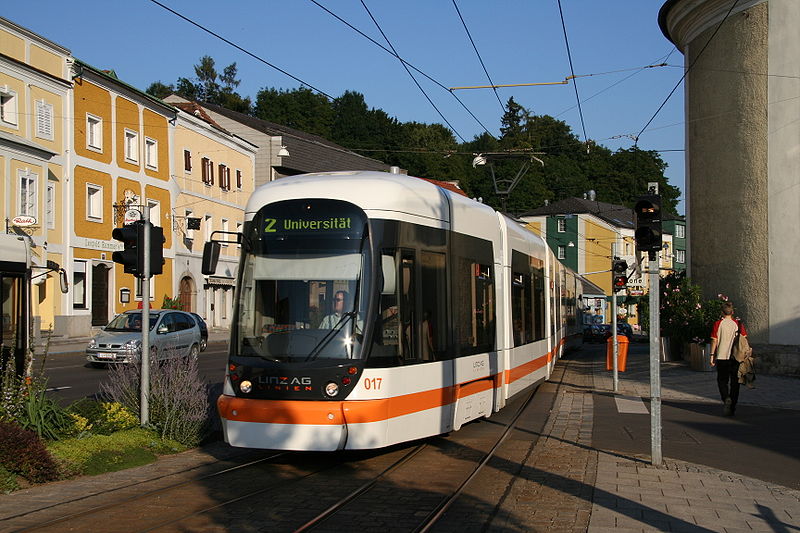
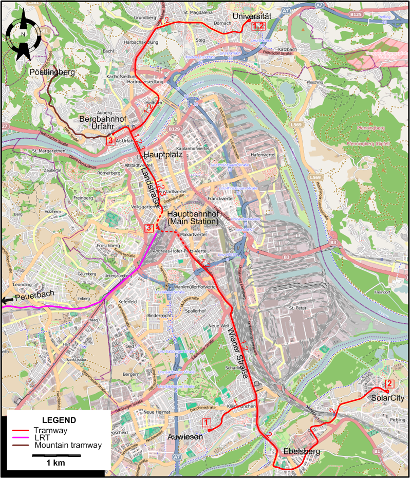
I created the above map by overlaying an OpenStreetMap (OSM) map with my own data. Copyright on the OSM map is ©
OpenStreetMap & Contributors, licensed under a CC-BY-SA (Creative Commons Attribution-ShareAlike 2.0 licence).
Please note that the OSM map used as a template for this map corresponds to the situation at the time the map was downloaded and may show features that did not exist at the time
the GS Tram Site is supposed to show. In particular, it may show bridges and highways that were built later.
ROUTES
Operator: Linz AG Linien
URBAN TRAM ROUTES
| 1 |
Universität - Hauptplatz - Landstraße - Hauptbahnhof - Wiener Straße - Auwiesen |
| 2 |
Universität - Hauptplatz - Landstraße - Hauptbahnhof - Wiener Straße - Ebelsberg - SolarCity |
| 3 |
Bergbahnhof Urfahr - Hauptplatz - Landstraße - Hauptbahnhof |
MOUNTAIN TRAMWAY (PÖSTLINGBERGBAHN)
Operator: Stern & Hafferl Verkehrsgesellschaft
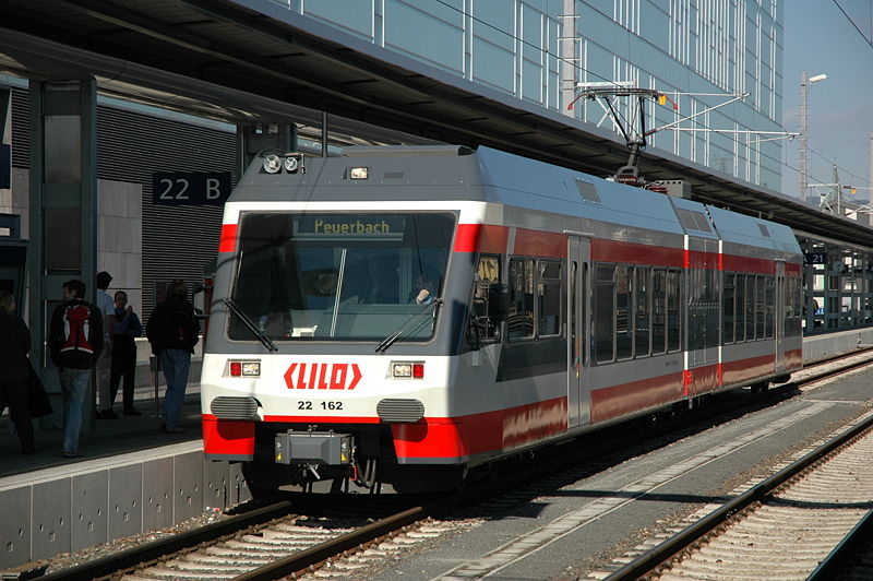
LINZER LOKALBAHN (LILO)
| |
Linz Hochbahnhof - Leonding - Hitzing - Eferding - Waizenkirchen - Peuerbach |
CHARACTERISTICS OF THE SYSTEM
NETWORK LENGTH
- Tramway: 21 km.
- Pöstlingbergbahn: 3 km
- Lokalbahn: 59 km.
HISTORY
- Tramway: 1898 - today.
- Pöstlingbergbahn: 29 May 1898 - today.
- Lokalbahn: 1912 - today.
GAUGE
- Tramway: 900 mm.
- Pöstlingbergbahn: 1000 mm. (1898 - 25 March 2008); 900 mm (29 May 2009 - today)
- Lokalbahn: 1435 mm.
SOURCES
PRINT
- Buckley, R.J. Tramways and Light Railways of Switzerland and Austria. Milton Keynes (England): Light Rail Transit Association, 1st ed., 1984.
- Buckley, R.J. Tramways and Light Railways of Switzerland and Austria. Milton Keynes (England): Light Rail Transit Association, 2nd ed., 2000.
- Russell, M. "110 years of unblemished service [The Pöstlingbergbahn]" Tramways & Urban Transit, June 2008 (71: 846), p.244-245.
- Wansbeek, C.J. "Linz: Narrow gauge, broad vision", Tramways & Urban Transit, May 2002 (64: 773), p.174-179.
WIKIS
WEB SITES
|