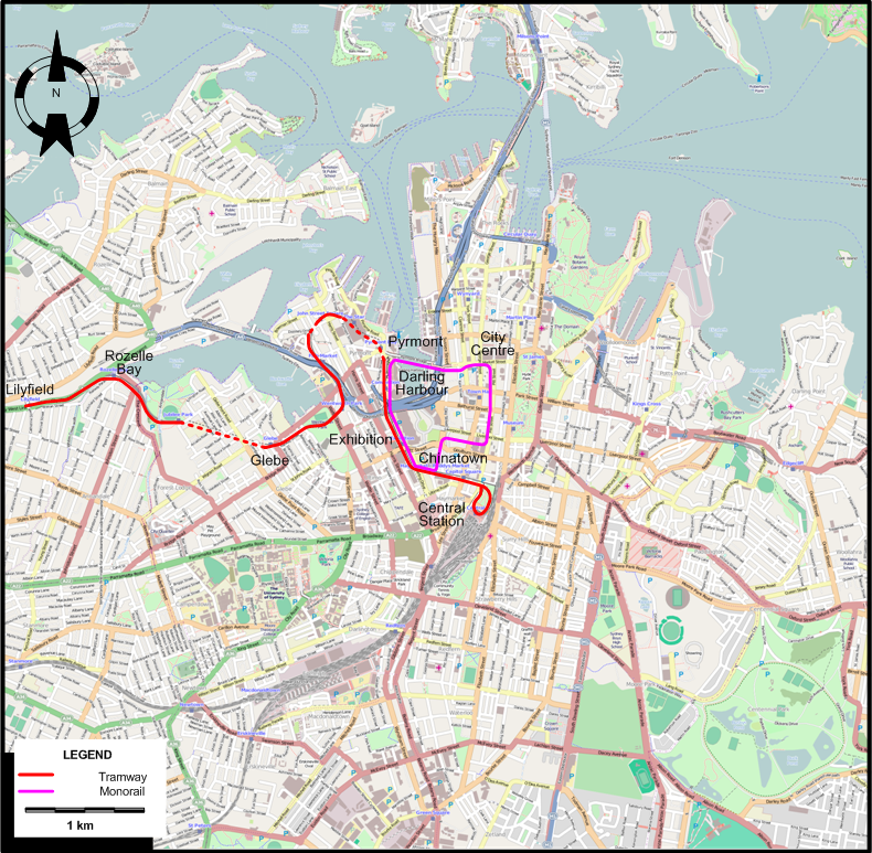
THE GS TRAM SITE

SYDNEY

NEW SOUTH WALES, AUSTRALIA

flag.aus

2000 (UP-TO-DATE)

Sydney after the reintroduction of tram (Light Rail) services


AUSTRALIA

MELBOURNE

SYDNEY


GS Web Site Home


Sydney-2000 tram map


INSET: DOWNTOWN SYDNEY

Sydney-2000 downtown tram map


ROUTES

Operator: Metro Transport Sydney

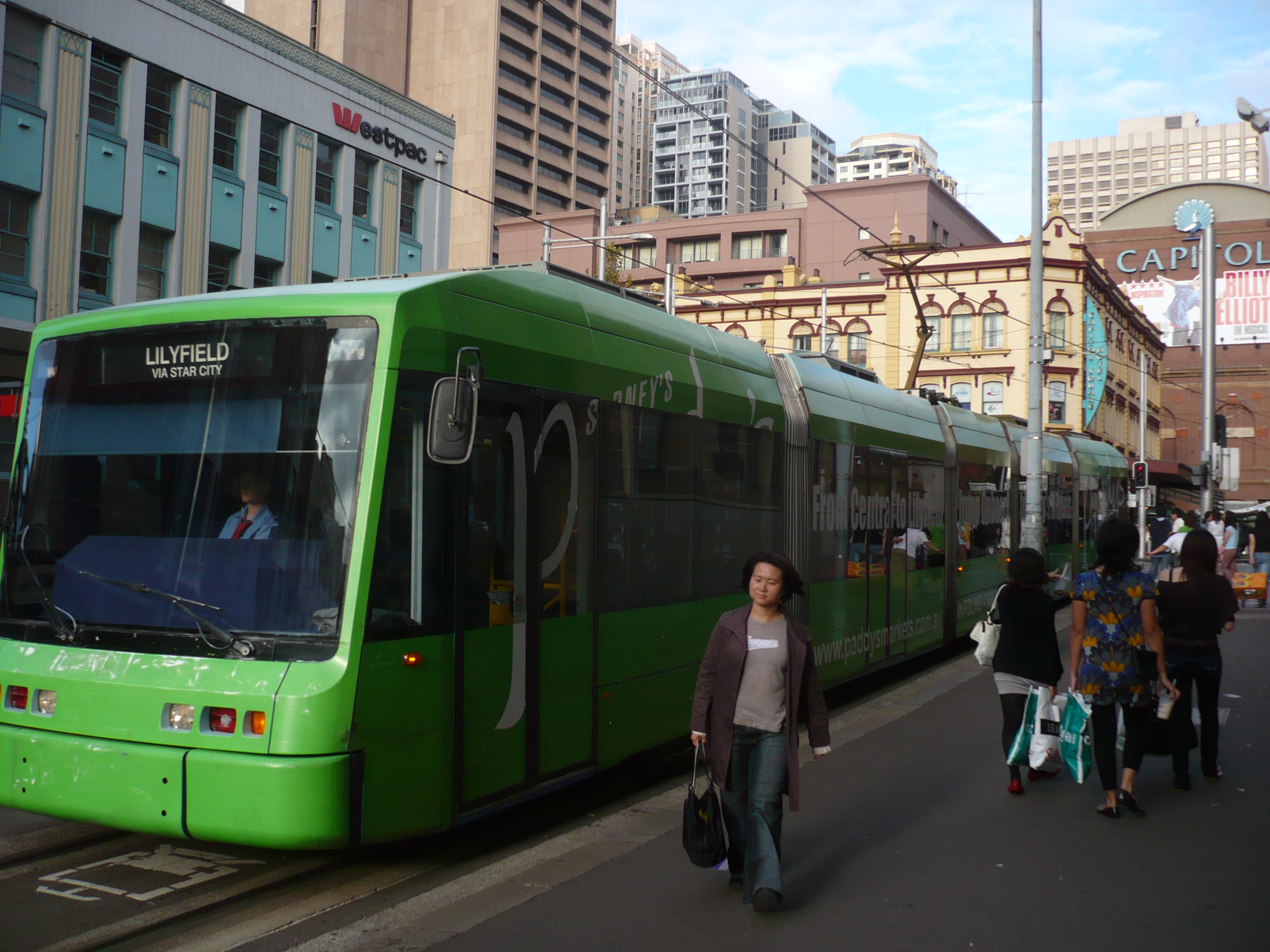
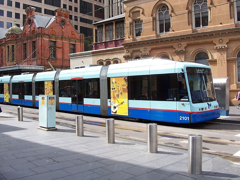
LIGHT RAIL (TRAM) ROUTE

Metro Light Rail Central Station - Chinatown - Darling Harbour - Pyrmont - Glebe - Rozelle Bay - Lilyfield
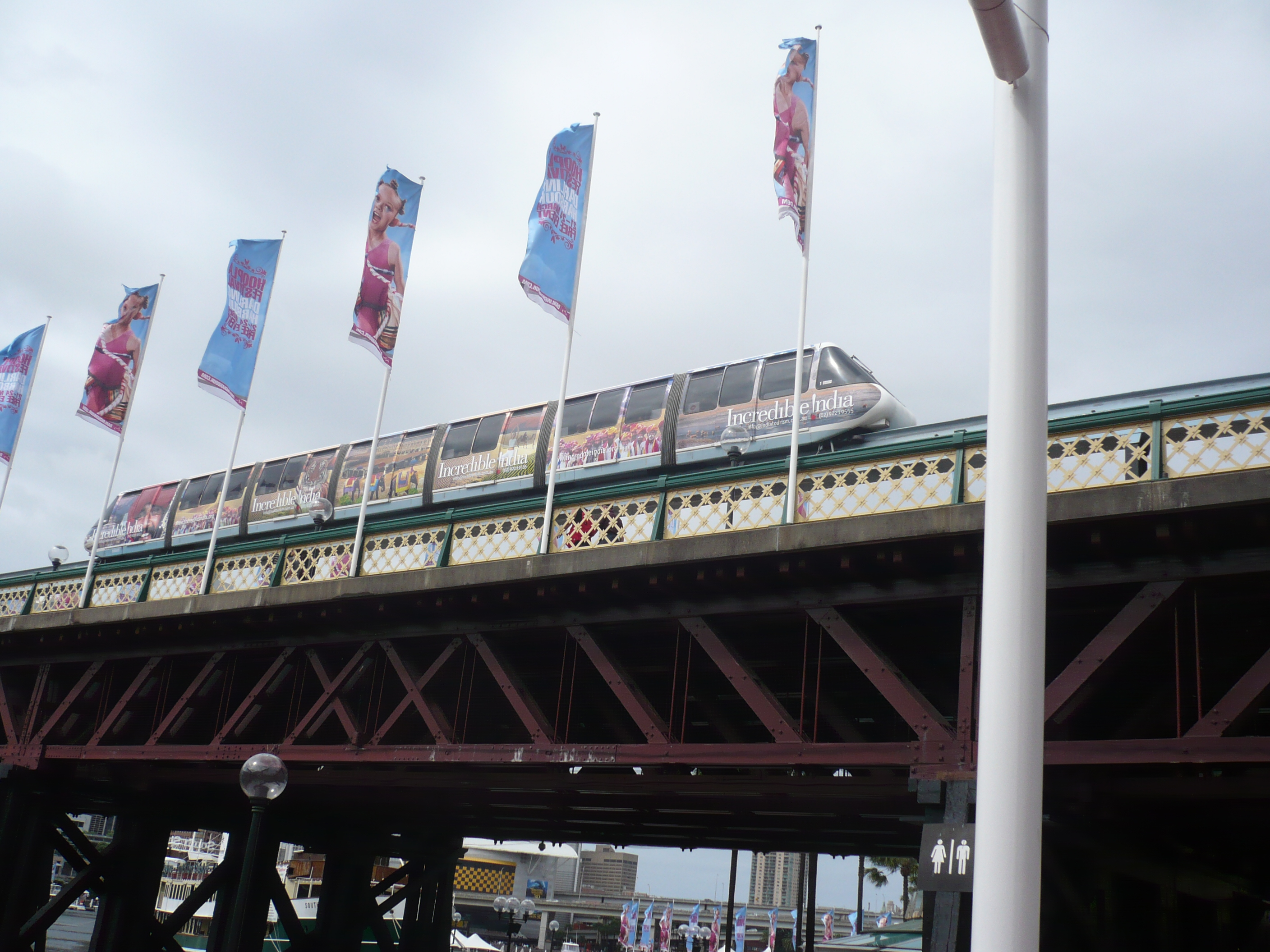
MONORAIL ROUTE

Metro Monorail City Centre - Darling Harbour - Chinatown - City Centre [Circular route, one way]


CHARACTERISTICS OF THE SYSTEM

NETWORK LENGTH

  • Light Rail (Tram) line: 7.2 km.
  • Monorail: 3.6 km.


HISTORY

  • Horse tramways: 23 Dec. 1861 - 31 Dec. 1866. (Also, short-lived systems in 1879, 1894)
  • Steam tramways: 30 Sept. 1879 - 1910 (on the private line Parramatta to Redbank Wharf (Duck River) until 1943).
  • Cable tramways: 1894 - 14 Jan. 1905.
  • Electric tramways (first generation): 9 Nov. 1890 - 20 Apr. 1892; 8 Dec. 1899 - 25 Feb. 1961.
  • Electric tramways (second generation): 11 Aug. 1997 - today.
  • Monorail: July 1988 - today.

GAUGE

  • All tramways: 1435 mm.

TRAM PRESERVATION

The Sydney Tramway Museum in Loftus, about 30 km south of the city centre, runs old trams along 3.5 km. of track.


SOURCES

PRINT

  • Keenan, D.R. Tramways of Sydney. Sans Souci (N.S.W.): Transit Press, 1979.
  • Sydney Tramway Museum: Visit souvenir. Sutherland (N.S.W.): South Pacific Electric Railway Co-operative Society, 2004

WIKIS

WEB SITES


Hit count for this page: hit count

Valid HTML 4.01!


Copyright Gabor Sandi 1998-2008

To get in touch with the webmaster, send an e-mail to g_sandi@hotmail.com

Flags on this site are from the FOTW Flags Of The World website.